Molochnoye geodata
Molochnoye (Republic of Crimea) is a seat of a third-order administrative division; located in Ukraine in Europe/Simferopol (GMT+3) time zone. With population of 2,174 people, there are 1080 cities with bigger population in this country. Compared to other cities in Ukraine, 85.8% of cities are located further ↑North; 51.3% of cities are located further →East and 98.6% of cities have higher elevation than Molochnoye. Note1
Administrative division(s):
- Level 1: Republic of Crimea
- Level 2: Sakskiy rayon
- Level 3: Molochnenskoye sel'skoye poselenye


Molochnoye GPS coordinates[2]
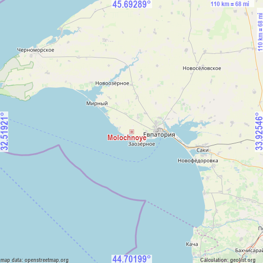
45° 11' 58.56" North, 33° 13' 20.388" East
| Map corner | latitude | longitude |
|---|---|---|
| Upper-left | 45.69289°, | 32.51921° |
| Center: | 45.1996°, | 33.22233° |
| Lower-right: | 44.70199°, | 33.92546° |
| Map W x H: | 110.2×110.2 km | = 68.5×68.5mi |
| max Lat: | 52.18903° ⇑85.8% North |
| Molochnoye: | 45.1996° |
| min Lat: | ⇓14.2% South 44.39214° |
| min Long | Molochnoye | max Long |
| 22.20555° | 33.22233° | 40.13222° |
| W 48.7%⇐ | ⇒51.3% E |
Elevation
Elevation of Molochnoye is 6 m = 20 ft, and this is 149.8 m = 491 ft below average elevation for this country.
| Max E: |
886 m = 2907 ft | 98.6% |
| Avg. | 155.8 m = 511 ft | |
| Molochnoye | 6 m = 20 ft | |
Min E: |
-3 m = -10 ft | 1.4% |
See also: Ukraine elevation on elevation.city.
Geographical zone
Molochnoye is located in North temperate zone (between Tropic of Cancer and the Arctic Circle). Distance of this North polar circle is 2375.4 km =1476 mi to North.| Distance of | km | miles | from Molochnoye |
|---|---|---|---|
| North Pole | 4981.3 | 3095.2 | to North |
| Arctic Circle | 2375.4 | 1476 | to North |
| Tropic Cancer | 2419.8 | 1503.6 | to South |
| Equator | 5025.7 | 3122.8 | to South |


Nearby cities:
15 places around Molochnoye: (largest is in red/bold)
• Abrikosovka
8.3 km =5.2 mi,  342°
342°
• Kamenolomnya
16.2 km =10.1 mi,  70°
70°
• Koloski
9.6 km =6 mi,  35°
35°
• Mirny
19 km =11.8 mi,  309°
309°
• Novoozyornoye
22 km =13.7 mi, 338°
• Romashkino
6.8 km =4.2 mi,  22°
22°
• Shishkino
12.6 km =7.8 mi,  354°
354°
• Shtormovoye
13 km =8.1 mi, 305°
• Suvorovskoye
13.1 km =8.1 mi,  63°
63°
• Uyutnoye
5.9 km =3.7 mi,  92°
92°
• Veselovka
19.8 km =12.3 mi,  358°
358°
• Vitino
5.3 km =3.3 mi,  290°
290°
• Vorobyovo
14.5 km =9 mi,  7°
7°
• Yevpatoriya
11.3 km =7 mi, 89°
• Zaozyornoye
6.4 km =4 mi,  136°
136°
Sources, notices
• [Note1] Compared only with cities in Ukraine existing in our database
• [Src1] Map data: © OpenStreetMap contributors (CC-BY-SA)
• [Src2] Other city data from geonames.org with taken over terms of usage.
• [Src3] Geographical zone / Annual Mean Temperature by Robert A. Rohde @ Wikipedia
