Pshenichnoye geodata
Pshenichnoye (Republic of Crimea) is a seat of a third-order administrative division; located in Ukraine in Europe/Simferopol (GMT+3) time zone. With population of 868 people, there are 1453 cities with bigger population in this country. Compared to other cities in Ukraine, 74.5% of cities are located further ↑North; 78.3% of cities are located further ←West and 98% of cities have higher elevation than Pshenichnoye. Note1
Administrative division(s):
- Level 1: Republic of Crimea
- Level 2: Nizhnegorskiy rayon
- Level 3: Pshenichnenskoye sel'skoye poselenye


Pshenichnoye GPS coordinates[2]
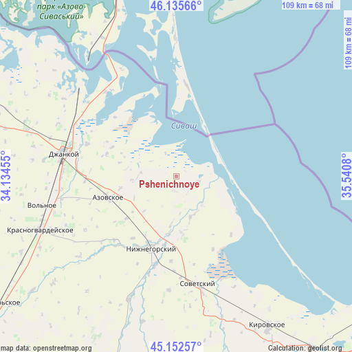
45° 38' 46.572" North, 34° 50' 15.612" East
| Map corner | latitude | longitude |
|---|---|---|
| Upper-left | 46.13566°, | 34.13455° |
| Center: | 45.64627°, | 34.83767° |
| Lower-right: | 45.15257°, | 35.5408° |
| Map W x H: | 109.3×109.3 km | = 67.9×67.9mi |
| max Lat: | 52.18903° ⇑74.5% North |
| Pshenichnoye: | 45.64627° |
| min Lat: | ⇓25.5% South 44.39214° |
| min Long | Pshenichnoye | max Long |
| 22.20555° | 34.83767° | 40.13222° |
| W 78.3%⇐ | ⇒21.7% E |
Elevation
Elevation of Pshenichnoye is 7 m = 23 ft, and this is 148.8 m = 488 ft below average elevation for this country.
| Max E: |
886 m = 2907 ft | 98% |
| Avg. | 155.8 m = 511 ft | |
| Pshenichnoye | 7 m = 23 ft | |
Min E: |
-3 m = -10 ft | 2% |
See also: Ukraine elevation on elevation.city.
Geographical zone
Pshenichnoye is located in North temperate zone (between Tropic of Cancer and the Arctic Circle). Distance of this North polar circle is 2325.8 km =1445.2 mi to North.| Distance of | km | miles | from Pshenichnoye |
|---|---|---|---|
| North Pole | 4931.7 | 3064.4 | to North |
| Arctic Circle | 2325.8 | 1445.2 | to North |
| Tropic Cancer | 2469.5 | 1534.5 | to South |
| Equator | 5075.4 | 3153.7 | to South |


Nearby cities:
15 places around Pshenichnoye: (largest is in red/bold)
• Akimovka
14.1 km =8.8 mi,  184°
184°
• Borodino
11.9 km =7.4 mi,  268°
268°
• Chkalovo
4.6 km =2.9 mi, 183°
• Izobil’noye
11.9 km =7.4 mi,  135°
135°
• Listvennoye
18.5 km =11.5 mi,  186°
186°
• Mikhaylovka
20.2 km =12.6 mi,  229°
229°
• Novoivanovka
21.1 km =13.1 mi, 188°
• Okhotskoye
17.9 km =11.1 mi,  173°
173°
• Prostornoye
10.9 km =6.8 mi,  275°
275°
• Semennoye
21.8 km =13.5 mi,  195°
195°
• Svetloye
13.7 km =8.5 mi,  263°
263°
• Tabachnoye
17.7 km =11 mi, 257°
• Yemelyanovka
13.4 km =8.3 mi,  160°
160°
• Zelyonoye
21.7 km =13.5 mi, 202°
• Zorkino
14.8 km =9.2 mi,  222°
222°
Sources, notices
• [Note1] Compared only with cities in Ukraine existing in our database
• [Src1] Map data: © OpenStreetMap contributors (CC-BY-SA)
• [Src2] Other city data from geonames.org with taken over terms of usage.
• [Src3] Geographical zone / Annual Mean Temperature by Robert A. Rohde @ Wikipedia
