Serebryanka geodata
Serebryanka (Republic of Crimea) is a seat of a third-order administrative division; located in Ukraine in Europe/Simferopol (GMT+3) time zone. With population of 833 people, there are 1469 cities with bigger population in this country. Compared to other cities in Ukraine, 74.8% of cities are located further ↑North; 51.6% of cities are located further ←West and 63.5% of cities have higher elevation than Serebryanka. Note1
Administrative division(s):
- Level 1: Republic of Crimea
- Level 2: Razdol’nenskiy rayon
- Level 3: Serebryanskoye sel'skoye poselenye


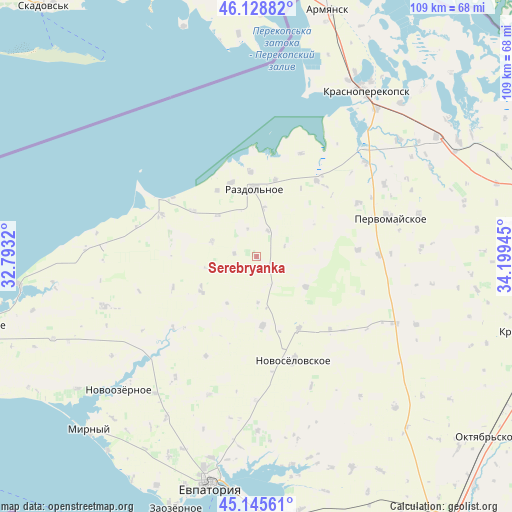
Serebryanka GPS coordinates[2]
45° 38' 21.732" North, 33° 29' 46.752" East
| Map corner | latitude | longitude |
|---|---|---|
| Upper-left | 46.12882°, | 32.7932° |
| Center: | 45.63937°, | 33.49632° |
| Lower-right: | 45.14561°, | 34.19945° |
| Map W x H: | 109.3×109.3 km | = 67.9×67.9mi |
| max Lat: | 52.18903° ⇑74.8% North |
| Serebryanka: | 45.63937° |
| min Lat: | ⇓25.2% South 44.39214° |
| min Long | Serebryanka | max Long |
| 22.20555° | 33.49632° | 40.13222° |
| W 51.6%⇐ | ⇒48.4% E |
Elevation
Elevation of Serebryanka is 95 m = 312 ft, and this is 60.8 m = 199 ft below average elevation for this country.
| Max E: |
886 m = 2907 ft | 63.5% |
| Avg. | 155.8 m = 511 ft | |
| Serebryanka | 95 m = 312 ft | |
Min E: |
-3 m = -10 ft | 36.5% |
See also: Ukraine elevation on elevation.city.
Geographical zone
Serebryanka is located in North temperate zone (between Tropic of Cancer and the Arctic Circle). Distance of this North polar circle is 2326.6 km =1445.7 mi to North.| Distance of | km | miles | from Serebryanka |
|---|---|---|---|
| North Pole | 4932.4 | 3064.9 | to North |
| Arctic Circle | 2326.6 | 1445.7 | to North |
| Tropic Cancer | 2468.7 | 1534 | to South |
| Equator | 5074.6 | 3153.2 | to South |


Nearby cities:
15 places around Serebryanka: (largest is in red/bold)
• Alekseyevka
12.2 km =7.6 mi,  121°
121°
• Berezovka
13.9 km =8.6 mi,  238°
238°
• Botanicheskoye
16.9 km =10.5 mi,  13°
13°
• Chernyshevo
16.7 km =10.4 mi,  341°
341°
• Kormovoye
17.9 km =11.1 mi,  149°
149°
• Kovyl’noye
6.2 km =3.9 mi,  23°
23°
• Kropotkino
18.3 km =11.4 mi,  356°
356°
• Kukushkino
12.1 km =7.5 mi,  317°
317°
• Niva
19 km =11.8 mi,  250°
250°
• Ogni
16.4 km =10.2 mi,  329°
329°
• Orlovka
10.1 km =6.3 mi,  289°
289°
• Razdol’noye
14.6 km =9.1 mi, 357°
• Senokosnoye
10.5 km =6.5 mi, 8°
• Slavyanskoye
16.7 km =10.4 mi,  305°
305°
• Zimino
14.7 km =9.1 mi,  174°
174°
Sources, notices
• [Note1] Compared only with cities in Ukraine existing in our database
• [Src1] Map data: © OpenStreetMap contributors (CC-BY-SA)
• [Src2] Other city data from geonames.org with taken over terms of usage.
• [Src3] Geographical zone / Annual Mean Temperature by Robert A. Rohde @ Wikipedia
