Berezovka geodata
Berezovka (Republic of Crimea) is a seat of a third-order administrative division; located in Ukraine in Europe/Simferopol (GMT+3) time zone. With population of 1,308 people, there are 1267 cities with bigger population in this country. Compared to other cities in Ukraine, 75.7% of cities are located further ↑North; 50.1% of cities are located further ←West and 77.6% of cities have higher elevation than Berezovka. Note1
Administrative division(s):
- Level 1: Republic of Crimea
- Level 2: Razdol’nenskiy rayon
- Level 3: Berezovskoye sel'skoye poselenye


Berezovka GPS coordinates[2]
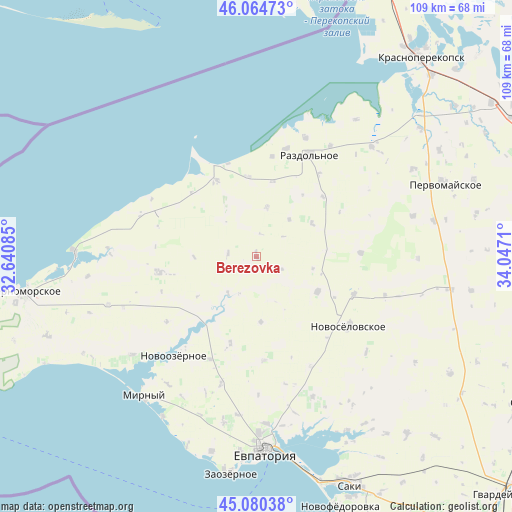
45° 34' 28.956" North, 33° 20' 38.292" East
| Map corner | latitude | longitude |
|---|---|---|
| Upper-left | 46.06473°, | 32.64085° |
| Center: | 45.57471°, | 33.34397° |
| Lower-right: | 45.08038°, | 34.0471° |
| Map W x H: | 109.4×109.4 km | = 68×68mi |
| max Lat: | 52.18903° ⇑75.7% North |
| Berezovka: | 45.57471° |
| min Lat: | ⇓24.3% South 44.39214° |
| min Long | Berezovka | max Long |
| 22.20555° | 33.34397° | 40.13222° |
| W 50.1%⇐ | ⇒49.9% E |
Elevation
Elevation of Berezovka is 52 m = 171 ft, and this is 103.8 m = 341 ft below average elevation for this country.
| Max E: |
886 m = 2907 ft | 77.6% |
| Avg. | 155.8 m = 511 ft | |
| Berezovka | 52 m = 171 ft | |
Min E: |
-3 m = -10 ft | 22.4% |
See also: Ukraine elevation on elevation.city.
Geographical zone
Berezovka is located in North temperate zone (between Tropic of Cancer and the Arctic Circle). Distance of this North polar circle is 2333.7 km =1450.1 mi to North.| Distance of | km | miles | from Berezovka |
|---|---|---|---|
| North Pole | 4939.6 | 3069.3 | to North |
| Arctic Circle | 2333.7 | 1450.1 | to North |
| Tropic Cancer | 2461.5 | 1529.5 | to South |
| Equator | 5067.4 | 3148.7 | to South |


Nearby cities:
15 places around Berezovka: (largest is in red/bold)
• Alekseyevka
22.3 km =13.9 mi,  87°
87°
• Kirovskoye
21 km =13 mi,  260°
260°
• Kovyl’noye
19.2 km =11.9 mi,  48°
48°
• Krasnoyarskoye
9.7 km =6 mi,  218°
218°
• Kukushkino
16.5 km =10.3 mi,  12°
12°
• Natashino
19.3 km =12 mi,  196°
196°
• Niva
6 km =3.7 mi,  276°
276°
• Ogni
21.6 km =13.4 mi, 9°
• Orlovka
10.7 km =6.6 mi, 12°
• Senokosnoye
22.1 km =13.7 mi,  37°
37°
• Serebryanka
13.9 km =8.6 mi,  58°
58°
• Slavnoye
18.3 km =11.4 mi,  333°
333°
• Slavyanskoye
17.1 km =10.6 mi,  354°
354°
• Yelizavetovo
14 km =8.7 mi,  175°
175°
• Zimino
15.2 km =9.4 mi,  119°
119°
Sources, notices
• [Note1] Compared only with cities in Ukraine existing in our database
• [Src1] Map data: © OpenStreetMap contributors (CC-BY-SA)
• [Src2] Other city data from geonames.org with taken over terms of usage.
• [Src3] Geographical zone / Annual Mean Temperature by Robert A. Rohde @ Wikipedia
