Bohorodchany geodata
Bohorodchany (Ivano-Frankivsk) is a seat of a second-order administrative division; located in Ukraine in Europe/Kiev (GMT+3) time zone. With population of 7,328 people, there are 486 cities with bigger population in this country. Compared to other cities in Ukraine, 62.2% of cities are located further ↓South; 89.2% of cities are located further →East and 93.2% of cities have lower elevation than Bohorodchany. Note1


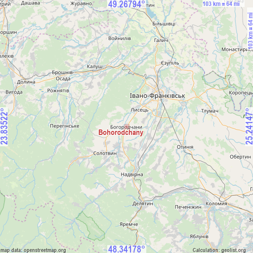
Bohorodchany GPS coordinates[2]
48° 48' 25.2" North, 24° 32' 18.024" East
| Map corner | latitude | longitude |
|---|---|---|
| Upper-left | 49.26794°, | 23.83522° |
| Center: | 48.807°, | 24.53834° |
| Lower-right: | 48.34178°, | 25.24147° |
| Map W x H: | 103×103 km | = 64×64mi |
| max Lat: | 52.18903° ⇑37.8% North |
| Bohorodchany: | 48.807° |
| min Lat: | ⇓62.2% South 44.39214° |
| min Long | Bohorodchany | max Long |
| 22.20555° | 24.53834° | 40.13222° |
| W 10.8%⇐ | ⇒89.2% E |
Elevation
Elevation of Bohorodchany is 334 m = 1096 ft, and this is 178.2 m = 585 ft above average elevation for this country.
| Max E: |
886 m = 2907 ft | 6.8% |
| Bohorodchany | 334 m 1096 ft | |
| Avg. | 155.8 m = 511 ft | |
Min E: |
-3 m = -10 ft | 93.2% |
See also: Ukraine elevation on elevation.city.
Geographical zone
Bohorodchany is located in North temperate zone (between Tropic of Cancer and the Arctic Circle). Distance of this North polar circle is 1974.3 km =1226.8 mi to North.| Distance of | km | miles | from Bohorodchany |
|---|---|---|---|
| North Pole | 4580.2 | 2846 | to North |
| Arctic Circle | 1974.3 | 1226.8 | to North |
| Tropic Cancer | 2820.9 | 1752.8 | to South |
| Equator | 5426.8 | 3372.1 | to South |


Nearby cities:
15 places around Bohorodchany: (largest is in red/bold)
• Bytkiv
20.3 km =12.6 mi,  193°
193°
• Cherniyiv
14 km =8.7 mi,  66°
66°
• Hvizd
13.6 km =8.5 mi,  176°
176°
• Ivano-Frankivsk
17.9 km =11.1 mi,  44°
44°
• Kosmach
14 km =8.7 mi,  243°
243°
• Manyava
20.7 km =12.9 mi,  215°
215°
• Markova
17.2 km =10.7 mi,  212°
212°
• Nadvirna
19.3 km =12 mi,  173°
173°
• Petranka
20.2 km =12.6 mi,  301°
301°
• Radcha
9.8 km =6.1 mi,  60°
60°
• Solotvyn
14.4 km =8.9 mi, 216°
• Stari Bohorodchany
3.1 km =1.9 mi,  340°
340°
• Tysmenychany
10.2 km =6.3 mi,  112°
112°
• Uhryniv
20 km =12.4 mi,  34°
34°
• Zahvizdya
14.9 km =9.3 mi, 34°
Sources, notices
• [Note1] Compared only with cities in Ukraine existing in our database
• [Src1] Map data: © OpenStreetMap contributors (CC-BY-SA)
• [Src2] Other city data from geonames.org with taken over terms of usage.
• [Src3] Geographical zone / Annual Mean Temperature by Robert A. Rohde @ Wikipedia
