Stari Bohorodchany geodata
Stari Bohorodchany (Ivano-Frankivsk) is a populated place; located in Ukraine in Europe/Kiev (GMT+3) time zone. With population of 3,426 people, there are 844 cities with bigger population in this country. Compared to other cities in Ukraine, 62.7% of cities are located further ↓South; 89.4% of cities are located further →East and 90.6% of cities have lower elevation than Stari Bohorodchany. Note1


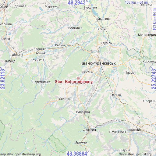
Stari Bohorodchany GPS coordinates[2]
48° 50' 0.996" North, 24° 31' 27.48" East
| Map corner | latitude | longitude |
|---|---|---|
| Upper-left | 49.2943°, | 23.82118° |
| Center: | 48.83361°, | 24.5243° |
| Lower-right: | 48.36864°, | 25.22743° |
| Map W x H: | 102.9×102.9 km | = 63.9×63.9mi |
| max Lat: | 52.18903° ⇑37.3% North |
| Stari Bohorodchany: | 48.83361° |
| min Lat: | ⇓62.7% South 44.39214° |
| min Long | Stari Bohorodch | max Long |
| 22.20555° | 24.5243° | 40.13222° |
| W 10.6%⇐ | ⇒89.4% E |
Elevation
Elevation of Stari Bohorodchany is 312 m = 1024 ft, and this is 156.2 m = 512 ft above average elevation for this country.
| Max E: |
886 m = 2907 ft | 9.4% |
| Stari Bohorodchany | 312 m 1024 ft | |
| Avg. | 155.8 m = 511 ft | |
Min E: |
-3 m = -10 ft | 90.6% |
See also: Ukraine elevation on elevation.city.
Geographical zone
Stari Bohorodchany is located in North temperate zone (between Tropic of Cancer and the Arctic Circle). Distance of this North polar circle is 1971.4 km =1225 mi to North.| Distance of | km | miles | from Stari Bohorodchany |
|---|---|---|---|
| North Pole | 4577.3 | 2844.2 | to North |
| Arctic Circle | 1971.4 | 1225 | to North |
| Tropic Cancer | 2823.9 | 1754.7 | to South |
| Equator | 5429.8 | 3373.9 | to South |


Nearby cities:
15 places around Stari Bohorodchany: (largest is in red/bold)
• Bohorodchany
3.1 km =1.9 mi,  160°
160°
• Cherniyiv
14.1 km =8.8 mi,  79°
79°
• Hvizd
16.6 km =10.3 mi,  173°
173°
• Ivano-Frankivsk
16.7 km =10.4 mi,  54°
54°
• Kosmach
14.7 km =9.1 mi,  231°
231°
• Markova
19.3 km =12 mi,  204°
204°
• Nadvirna
22.4 km =13.9 mi, 171°
• Novytsya
20 km =12.4 mi,  316°
316°
• Petranka
17.9 km =11.1 mi,  295°
295°
• Radcha
9.7 km =6 mi, 79°
• Solotvyn
16.4 km =10.2 mi,  207°
207°
• Tysmenychany
12.5 km =7.8 mi,  123°
123°
• Uhryniv
18.3 km =11.4 mi,  42°
42°
• Yamnytsya
21.9 km =13.6 mi, 37°
• Zahvizdya
13.3 km =8.3 mi, 44°
Sources, notices
• [Note1] Compared only with cities in Ukraine existing in our database
• [Src1] Map data: © OpenStreetMap contributors (CC-BY-SA)
• [Src2] Other city data from geonames.org with taken over terms of usage.
• [Src3] Geographical zone / Annual Mean Temperature by Robert A. Rohde @ Wikipedia
