Kryva geodata
Kryva (Transcarpathia) is a populated place; located in Ukraine in Europe/Uzhgorod (GMT+3) time zone. With population of 2,911 people, there are 971 cities with bigger population in this country. Compared to other cities in Ukraine, 52.8% of cities are located further ↑North; 97.2% of cities are located further →East and 58.5% of cities have lower elevation than Kryva. Note1


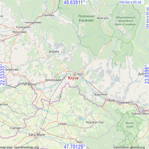
Kryva GPS coordinates[2]
48° 10' 20.424" North, 23° 14' 11.292" East
| Map corner | latitude | longitude |
|---|---|---|
| Upper-left | 48.63911°, | 22.53335° |
| Center: | 48.17234°, | 23.23647° |
| Lower-right: | 47.70129°, | 23.9396° |
| Map W x H: | 104.3×104.3 km | = 64.8×64.8mi |
| max Lat: | 52.18903° ⇑52.8% North |
| Kryva: | 48.17234° |
| min Lat: | ⇓47.2% South 44.39214° |
| min Long | Kryva | max Long |
| 22.20555° | 23.23647° | 40.13222° |
| W 2.8%⇐ | ⇒97.2% E |
Elevation
Elevation of Kryva is 163 m = 535 ft, and this is 7.2 m = 24 ft above average elevation for this country.
| Max E: |
886 m = 2907 ft | 41.5% |
| Kryva | 163 m 535 ft | |
| Avg. | 155.8 m = 511 ft | |
Min E: |
-3 m = -10 ft | 58.5% |
See also: Ukraine elevation on elevation.city.
Geographical zone
Kryva is located in North temperate zone (between Tropic of Cancer and the Arctic Circle). Distance of this North polar circle is 2044.9 km =1270.6 mi to North.| Distance of | km | miles | from Kryva |
|---|---|---|---|
| North Pole | 4650.8 | 2889.9 | to North |
| Arctic Circle | 2044.9 | 1270.6 | to North |
| Tropic Cancer | 2750.3 | 1709 | to South |
| Equator | 5356.3 | 3328.2 | to South |


Nearby cities:
15 places around Kryva: (largest is in red/bold)
• Bilky
17.6 km =10.9 mi,  334°
334°
• Dovhe
21.7 km =13.5 mi,  8°
8°
• Horinchovo
18.3 km =11.4 mi,  53°
53°
• Irshava
21.7 km =13.5 mi,  317°
317°
• Iza
8.3 km =5.2 mi,  55°
55°
• Khust
4.7 km =2.9 mi,  80°
80°
• Kopashnovo
19.1 km =11.9 mi,  74°
74°
• Korolevo
7.7 km =4.8 mi,  253°
253°
• Lypcha
14.7 km =9.1 mi, 47°
• Nyzhnye Selyshche
15.9 km =9.9 mi, 79°
• Oleshnyk
20.4 km =12.7 mi,  267°
267°
• Pidvynohradiv
20 km =12.4 mi,  259°
259°
• Rokosovo
6.1 km =3.8 mi,  313°
313°
• Vynohradiv
15.9 km =9.9 mi, 257°
• Vyshkovo
19.4 km =12.1 mi,  134°
134°
Sources, notices
• [Note1] Compared only with cities in Ukraine existing in our database
• [Src1] Map data: © OpenStreetMap contributors (CC-BY-SA)
• [Src2] Other city data from geonames.org with taken over terms of usage.
• [Src3] Geographical zone / Annual Mean Temperature by Robert A. Rohde @ Wikipedia
