Irshava geodata
Irshava (Transcarpathia) is a seat of a second-order administrative division; located in Ukraine in Europe/Uzhgorod (GMT+3) time zone. With population of 9,161 people, there are 393 cities with bigger population in this country. Compared to other cities in Ukraine, 50.3% of cities are located further ↓South; 97.9% of cities are located further →East and 51.5% of cities have lower elevation than Irshava. Note1


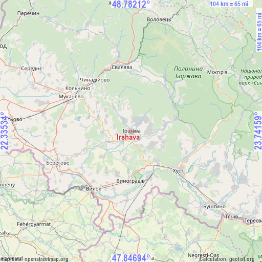
Irshava GPS coordinates[2]
48° 19' 0.012" North, 23° 2' 18.456" East
| Map corner | latitude | longitude |
|---|---|---|
| Upper-left | 48.78212°, | 22.33534° |
| Center: | 48.31667°, | 23.03846° |
| Lower-right: | 47.84694°, | 23.74159° |
| Map W x H: | 104×104 km | = 64.6×64.6mi |
| max Lat: | 52.18903° ⇑49.7% North |
| Irshava: | 48.31667° |
| min Lat: | ⇓50.3% South 44.39214° |
| min Long | Irshava | max Long |
| 22.20555° | 23.03846° | 40.13222° |
| W 2.1%⇐ | ⇒97.9% E |
Elevation
Elevation of Irshava is 140 m = 459 ft, and this is 15.8 m = 52 ft below average elevation for this country.
| Max E: |
886 m = 2907 ft | 48.5% |
| Avg. | 155.8 m = 511 ft | |
| Irshava | 140 m = 459 ft | |
Min E: |
-3 m = -10 ft | 51.5% |
See also: Ukraine elevation on elevation.city.
Geographical zone
Irshava is located in North temperate zone (between Tropic of Cancer and the Arctic Circle). Distance of this North polar circle is 2028.9 km =1260.7 mi to North.| Distance of | km | miles | from Irshava |
|---|---|---|---|
| North Pole | 4634.8 | 2879.9 | to North |
| Arctic Circle | 2028.9 | 1260.7 | to North |
| Tropic Cancer | 2766.4 | 1719 | to South |
| Equator | 5372.3 | 3338.2 | to South |


Nearby cities:
15 places around Irshava: (largest is in red/bold)
• Bereznyky
25.7 km =16 mi,  31°
31°
• Bilky
7 km =4.3 mi,  91°
91°
• Chynadiyovo
24.4 km =15.2 mi,  318°
318°
• Dovhe
18.6 km =11.6 mi,  73°
73°
• Iza
24.3 km =15.1 mi,  117°
117°
• Khust
24.6 km =15.3 mi,  128°
128°
• Korolevo
19.7 km =12.2 mi,  158°
158°
• Kryva
21.7 km =13.5 mi,  137°
137°
• Kushnytsya
21.2 km =13.2 mi,  49°
49°
• Oleshnyk
17.9 km =11.1 mi,  198°
198°
• Pidvynohradiv
20.3 km =12.6 mi,  194°
194°
• Rokosovo
15.6 km =9.7 mi, 139°
• Svalyava
26 km =16.2 mi,  353°
353°
• Velyki Berehy
23.6 km =14.7 mi,  246°
246°
• Vynohradiv
19.5 km =12.1 mi,  182°
182°
Sources, notices
• [Note1] Compared only with cities in Ukraine existing in our database
• [Src1] Map data: © OpenStreetMap contributors (CC-BY-SA)
• [Src2] Other city data from geonames.org with taken over terms of usage.
• [Src3] Geographical zone / Annual Mean Temperature by Robert A. Rohde @ Wikipedia
