Kirovskoye geodata
Kirovskoye (Republic of Crimea) is a seat of a second-order administrative division; located in Ukraine in Europe/Simferopol (GMT+3) time zone. With population of 7,064 people, there are 504 cities with bigger population in this country. Compared to other cities in Ukraine, 85.2% of cities are located further ↑North; 82.4% of cities are located further ←West and 86.9% of cities have higher elevation than Kirovskoye. Note1
Administrative division(s):
- Level 1: Republic of Crimea
- Level 2: Kirovske Raion
- Level 3: Kirovskoye sel'skoye poselenye


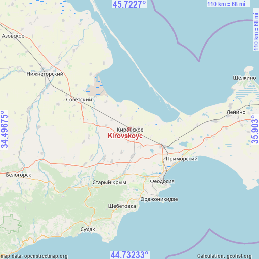
Kirovskoye GPS coordinates[2]
45° 13' 46.812" North, 35° 11' 59.532" East
| Map corner | latitude | longitude |
|---|---|---|
| Upper-left | 45.7227°, | 34.49675° |
| Center: | 45.22967°, | 35.19987° |
| Lower-right: | 44.73233°, | 35.903° |
| Map W x H: | 110.1×110.1 km | = 68.4×68.4mi |
| max Lat: | 52.18903° ⇑85.2% North |
| Kirovskoye: | 45.22967° |
| min Lat: | ⇓14.8% South 44.39214° |
| min Long | Kirovskoye | max Long |
| 22.20555° | 35.19987° | 40.13222° |
| W 82.4%⇐ | ⇒17.6% E |
Elevation
Elevation of Kirovskoye is 25 m = 82 ft, and this is 130.8 m = 429 ft below average elevation for this country.
| Max E: |
886 m = 2907 ft | 86.9% |
| Avg. | 155.8 m = 511 ft | |
| Kirovskoye | 25 m = 82 ft | |
Min E: |
-3 m = -10 ft | 13.1% |
See also: Ukraine elevation on elevation.city.
Geographical zone
Kirovskoye is located in North temperate zone (between Tropic of Cancer and the Arctic Circle). Distance of this North polar circle is 2372.1 km =1474 mi to North.| Distance of | km | miles | from Kirovskoye |
|---|---|---|---|
| North Pole | 4978 | 3093.2 | to North |
| Arctic Circle | 2372.1 | 1474 | to North |
| Tropic Cancer | 2423.1 | 1505.6 | to South |
| Equator | 5029.1 | 3124.9 | to South |


Nearby cities:
15 places around Kirovskoye: (largest is in red/bold)
• Abrikosovka
15.6 km =9.7 mi,  209°
209°
• Babenkovo
15.7 km =9.8 mi,  200°
200°
• Ilyichevo
10.2 km =6.3 mi,  279°
279°
• Novopokrovka
8.3 km =5.2 mi,  149°
149°
• Partizany
10.2 km =6.3 mi, 200°
• Shubino
4.9 km =3 mi,  11°
11°
• Sinitsyno
3.8 km =2.4 mi,  74°
74°
• Tokarevo
7.1 km =4.4 mi,  328°
328°
• Trudolyubovka
4 km =2.5 mi,  249°
249°
• Urozhaynoye
15.7 km =9.8 mi,  319°
319°
• Vladislavovka
15.4 km =9.6 mi,  116°
116°
• Vostochnoye
13.6 km =8.5 mi,  265°
265°
• Vozrozhdeniye
14.5 km =9 mi,  244°
244°
• Yarkoye Pole
2.7 km =1.7 mi,  182°
182°
• Zhuravki
11.6 km =7.2 mi,  174°
174°
Sources, notices
• [Note1] Compared only with cities in Ukraine existing in our database
• [Src1] Map data: © OpenStreetMap contributors (CC-BY-SA)
• [Src2] Other city data from geonames.org with taken over terms of usage.
• [Src3] Geographical zone / Annual Mean Temperature by Robert A. Rohde @ Wikipedia
