Kozachi Laheri geodata
Kozachi Laheri (Kherson) is a populated place; located in Ukraine in Europe/Kiev (GMT+3) time zone. With population of 3,587 people, there are 817 cities with bigger population in this country. Compared to other cities in Ukraine, 65.8% of cities are located further ↑North; 52.6% of cities are located further →East and 92.2% of cities have higher elevation than Kozachi Laheri. Note1


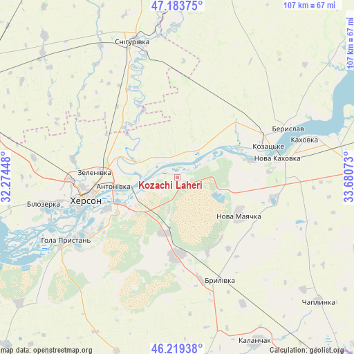
Kozachi Laheri GPS coordinates[2]
46° 42' 13.392" North, 32° 58' 39.36" East
| Map corner | latitude | longitude |
|---|---|---|
| Upper-left | 47.18375°, | 32.27448° |
| Center: | 46.70372°, | 32.9776° |
| Lower-right: | 46.21938°, | 33.68073° |
| Map W x H: | 107.2×107.2 km | = 66.6×66.6mi |
| max Lat: | 52.18903° ⇑65.8% North |
| Kozachi Laheri: | 46.70372° |
| min Lat: | ⇓34.2% South 44.39214° |
| min Long | Kozachi Laheri | max Long |
| 22.20555° | 32.9776° | 40.13222° |
| W 47.4%⇐ | ⇒52.6% E |
Elevation
Elevation of Kozachi Laheri is 16 m = 52 ft, and this is 139.8 m = 459 ft below average elevation for this country.
| Max E: |
886 m = 2907 ft | 92.2% |
| Avg. | 155.8 m = 511 ft | |
| Kozachi Laheri | 16 m = 52 ft | |
Min E: |
-3 m = -10 ft | 7.8% |
See also: Ukraine elevation on elevation.city.
Geographical zone
Kozachi Laheri is located in North temperate zone (between Tropic of Cancer and the Arctic Circle). Distance of this North polar circle is 2208.2 km =1372.1 mi to North.| Distance of | km | miles | from Kozachi Laheri |
|---|---|---|---|
| North Pole | 4814.1 | 2991.3 | to North |
| Arctic Circle | 2208.2 | 1372.1 | to North |
| Tropic Cancer | 2587 | 1607.5 | to South |
| Equator | 5193 | 3226.8 | to South |


Nearby cities:
15 places around Kozachi Laheri: (largest is in red/bold)
• Beryslav
37.6 km =23.4 mi,  65°
65°
• Brylivka
33.6 km =20.9 mi,  157°
157°
• Chornobayivka
32.3 km =20.1 mi,  268°
268°
• Chornyanka
29.7 km =18.5 mi,  101°
101°
• Dnipryany
23 km =14.3 mi,  78°
78°
• Kherson
28 km =17.4 mi,  259°
259°
• Komyshany
36.6 km =22.7 mi, 258°
• Malokakhovka
36.9 km =22.9 mi, 76°
• Nova Kakhovka
28.8 km =17.9 mi, 78°
• Nova Mayachka
22.3 km =13.9 mi,  121°
121°
• Oleksandrivka
22.3 km =13.9 mi,  312°
312°
• Radens’k
17.7 km =11 mi,  192°
192°
• Tsyurupyns’k
21.9 km =13.6 mi,  244°
244°
• Velyki Kopani
24.1 km =15 mi,  180°
180°
• Vynohradove
37.3 km =23.2 mi, 184°
Sources, notices
• [Note1] Compared only with cities in Ukraine existing in our database
• [Src1] Map data: © OpenStreetMap contributors (CC-BY-SA)
• [Src2] Other city data from geonames.org with taken over terms of usage.
• [Src3] Geographical zone / Annual Mean Temperature by Robert A. Rohde @ Wikipedia
