Oleksandrivka geodata
Oleksandrivka (Mykolaiv) is a populated place; located in Ukraine in Europe/Kiev (GMT+3) time zone. With population of 5,653 people, there are 592 cities with bigger population in this country. Compared to other cities in Ukraine, 64.8% of cities are located further ↑North; 53.9% of cities are located further →East and 82.5% of cities have higher elevation than Oleksandrivka. Note1


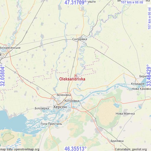
Oleksandrivka GPS coordinates[2]
46° 50' 17.736" North, 32° 45' 40.176" East
| Map corner | latitude | longitude |
|---|---|---|
| Upper-left | 47.31709°, | 32.05804° |
| Center: | 46.83826°, | 32.76116° |
| Lower-right: | 46.35513°, | 33.46429° |
| Map W x H: | 107×107 km | = 66.5×66.5mi |
| max Lat: | 52.18903° ⇑64.8% North |
| Oleksandrivka: | 46.83826° |
| min Lat: | ⇓35.2% South 44.39214° |
| min Long | Oleksandrivka | max Long |
| 22.20555° | 32.76116° | 40.13222° |
| W 46.1%⇐ | ⇒53.9% E |
Elevation
Elevation of Oleksandrivka is 37 m = 121 ft, and this is 118.8 m = 390 ft below average elevation for this country.
| Max E: |
886 m = 2907 ft | 82.5% |
| Avg. | 155.8 m = 511 ft | |
| Oleksandrivka | 37 m = 121 ft | |
Min E: |
-3 m = -10 ft | 17.5% |
See also: Ukraine elevation on elevation.city.
Geographical zone
Oleksandrivka is located in North temperate zone (between Tropic of Cancer and the Arctic Circle). Distance of this North polar circle is 2193.2 km =1362.8 mi to North.| Distance of | km | miles | from Oleksandrivka |
|---|---|---|---|
| North Pole | 4799.1 | 2982 | to North |
| Arctic Circle | 2193.2 | 1362.8 | to North |
| Tropic Cancer | 2602 | 1616.8 | to South |
| Equator | 5207.9 | 3236 | to South |


Nearby cities:
15 places around Oleksandrivka: (largest is in red/bold)
• Bilozerka
34 km =21.1 mi,  225°
225°
• Chornobayivka
22.5 km =14 mi,  224°
224°
• Chornyanka
50 km =31.1 mi,  114°
114°
• Dnipryany
40.3 km =25 mi,  104°
104°
• Hola Prystan’
39 km =24.2 mi,  207°
207°
• Kherson
23 km =14.3 mi, 208°
• Komyshany
29.6 km =18.4 mi, 220°
• Kozachi Laheri
22.3 km =13.9 mi,  132°
132°
• Nova Kakhovka
45.7 km =28.4 mi, 101°
• Nova Mayachka
44.3 km =27.5 mi, 126°
• Radens’k
34.6 km =21.5 mi,  158°
158°
• Shevchenkove
42.5 km =26.4 mi,  273°
273°
• Snihurivka
26.6 km =16.5 mi,  7°
7°
• Tsyurupyns’k
24.7 km =15.3 mi,  187°
187°
• Velyki Kopani
42.3 km =26.3 mi, 157°
Sources, notices
• [Note1] Compared only with cities in Ukraine existing in our database
• [Src1] Map data: © OpenStreetMap contributors (CC-BY-SA)
• [Src2] Other city data from geonames.org with taken over terms of usage.
• [Src3] Geographical zone / Annual Mean Temperature by Robert A. Rohde @ Wikipedia
