Kayiry geodata
Kayiry (Kherson) is a populated place; located in Ukraine in Europe/Kiev (GMT+3) time zone. With population of 3,364 people, there are 855 cities with bigger population in this country. Compared to other cities in Ukraine, 64.2% of cities are located further ↑North; 55.7% of cities are located further ←West and 74.2% of cities have higher elevation than Kayiry. Note1


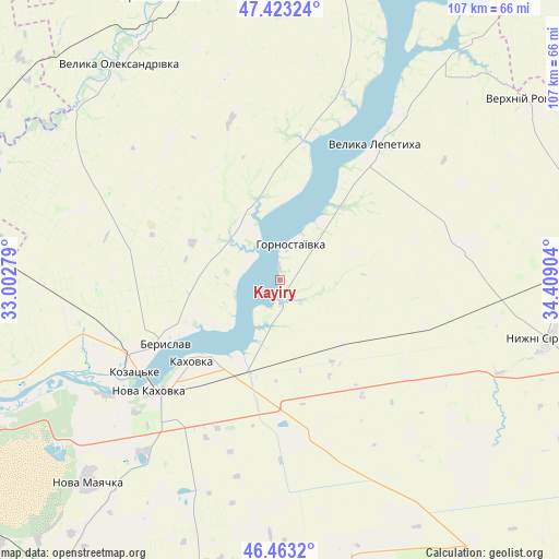
Kayiry GPS coordinates[2]
46° 56' 43.332" North, 33° 42' 21.276" East
| Map corner | latitude | longitude |
|---|---|---|
| Upper-left | 47.42324°, | 33.00279° |
| Center: | 46.94537°, | 33.70591° |
| Lower-right: | 46.4632°, | 34.40904° |
| Map W x H: | 106.7×106.7 km | = 66.3×66.3mi |
| max Lat: | 52.18903° ⇑64.2% North |
| Kayiry: | 46.94537° |
| min Lat: | ⇓35.8% South 44.39214° |
| min Long | Kayiry | max Long |
| 22.20555° | 33.70591° | 40.13222° |
| W 55.7%⇐ | ⇒44.3% E |
Elevation
Elevation of Kayiry is 63 m = 207 ft, and this is 92.8 m = 304 ft below average elevation for this country.
| Max E: |
886 m = 2907 ft | 74.2% |
| Avg. | 155.8 m = 511 ft | |
| Kayiry | 63 m = 207 ft | |
Min E: |
-3 m = -10 ft | 25.8% |
See also: Ukraine elevation on elevation.city.
Geographical zone
Kayiry is located in North temperate zone (between Tropic of Cancer and the Arctic Circle). Distance of this North polar circle is 2181.3 km =1355.4 mi to North.| Distance of | km | miles | from Kayiry |
|---|---|---|---|
| North Pole | 4787.2 | 2974.6 | to North |
| Arctic Circle | 2181.3 | 1355.4 | to North |
| Tropic Cancer | 2613.9 | 1624.2 | to South |
| Equator | 5219.8 | 3243.4 | to South |


Nearby cities:
15 places around Kayiry: (largest is in red/bold)
• Askaniya-Nova
56.3 km =35 mi,  167°
167°
• Beryslav
24 km =14.9 mi,  241°
241°
• Chornyanka
41.9 km =26 mi,  219°
219°
• Dnipryany
39.7 km =24.7 mi, 236°
• Dudchany
27.1 km =16.8 mi,  9°
9°
• Hornostayivka
7.2 km =4.5 mi, 14°
• Kakhovka
22.2 km =13.8 mi,  228°
228°
• Lyubymivka
18.3 km =11.4 mi,  214°
214°
• Malokakhovka
26.8 km =16.7 mi, 227°
• Nova Kakhovka
34.5 km =21.4 mi, 232°
• Nova Mayachka
53 km =32.9 mi, 223°
• Nyzhni Sirohozy
52.4 km =32.6 mi,  101°
101°
• Velyka Lepetykha
31.3 km =19.4 mi,  35°
35°
• Velyka Oleksandrivka
51.6 km =32.1 mi,  323°
323°
• Verkhniy Rohachyk
58.7 km =36.5 mi,  54°
54°
Sources, notices
• [Note1] Compared only with cities in Ukraine existing in our database
• [Src1] Map data: © OpenStreetMap contributors (CC-BY-SA)
• [Src2] Other city data from geonames.org with taken over terms of usage.
• [Src3] Geographical zone / Annual Mean Temperature by Robert A. Rohde @ Wikipedia
