Velyka Lepetykha geodata
Velyka Lepetykha (Kherson) is a seat of a second-order administrative division; located in Ukraine in Europe/Kiev (GMT+3) time zone. With population of 9,511 people, there are 375 cities with bigger population in this country. Compared to other cities in Ukraine, 62.9% of cities are located further ↑North; 61.1% of cities are located further ←West and 79% of cities have higher elevation than Velyka Lepetykha. Note1


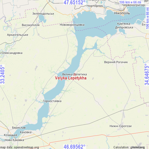
Velyka Lepetykha GPS coordinates[2]
47° 10' 32.592" North, 33° 56' 37.032" East
| Map corner | latitude | longitude |
|---|---|---|
| Upper-left | 47.65152°, | 33.2405° |
| Center: | 47.17572°, | 33.94362° |
| Lower-right: | 46.69562°, | 34.64675° |
| Map W x H: | 106.3×106.3 km | = 66.1×66.1mi |
| max Lat: | 52.18903° ⇑62.9% North |
| Velyka Lepetykha: | 47.17572° |
| min Lat: | ⇓37.1% South 44.39214° |
| min Long | Velyka Lepetykh | max Long |
| 22.20555° | 33.94362° | 40.13222° |
| W 61.1%⇐ | ⇒38.9% E |
Elevation
Elevation of Velyka Lepetykha is 46 m = 151 ft, and this is 109.8 m = 360 ft below average elevation for this country.
| Max E: |
886 m = 2907 ft | 79% |
| Avg. | 155.8 m = 511 ft | |
| Velyka Lepetykha | 46 m = 151 ft | |
Min E: |
-3 m = -10 ft | 21% |
See also: Ukraine elevation on elevation.city.
Geographical zone
Velyka Lepetykha is located in North temperate zone (between Tropic of Cancer and the Arctic Circle). Distance of this North polar circle is 2155.7 km =1339.5 mi to North.| Distance of | km | miles | from Velyka Lepetykha |
|---|---|---|---|
| North Pole | 4761.6 | 2958.7 | to North |
| Arctic Circle | 2155.7 | 1339.5 | to North |
| Tropic Cancer | 2639.5 | 1640.1 | to South |
| Equator | 5245.4 | 3259.3 | to South |


Nearby cities:
15 places around Velyka Lepetykha: (largest is in red/bold)
• Beryslav
53.9 km =33.5 mi,  226°
226°
• Chortomlyk
51.9 km =32.2 mi,  16°
16°
• Dudchany
13.6 km =8.5 mi,  274°
274°
• Hornostayivka
24.8 km =15.4 mi,  221°
221°
• Kakhovka
53.1 km =33 mi, 220°
• Kamenka-Na-Dnepre
49.2 km =30.6 mi,  45°
45°
• Kayiry
31.3 km =19.4 mi, 215°
• Lyubymivka
49.6 km =30.8 mi, 215°
• Novovorontsovka
36.1 km =22.4 mi,  356°
356°
• Nyzhni Sirohozy
49.2 km =30.6 mi,  137°
137°
• Ordzhonikidze
55.4 km =34.4 mi,  9°
9°
• Velyka Oleksandrivka
50.9 km =31.6 mi,  288°
288°
• Verkhniy Rohachyk
30.9 km =19.2 mi,  74°
74°
• Vodyane
54 km =33.6 mi, 50°
• Vysokopillya
47 km =29.2 mi,  318°
318°
Sources, notices
• [Note1] Compared only with cities in Ukraine existing in our database
• [Src1] Map data: © OpenStreetMap contributors (CC-BY-SA)
• [Src2] Other city data from geonames.org with taken over terms of usage.
• [Src3] Geographical zone / Annual Mean Temperature by Robert A. Rohde @ Wikipedia
