Velyka Oleksandrivka geodata
Velyka Oleksandrivka (Kherson) is a seat of a second-order administrative division; located in Ukraine in Europe/Kiev (GMT+3) time zone. With population of 7,281 people, there are 492 cities with bigger population in this country. Compared to other cities in Ukraine, 61.9% of cities are located further ↑North; 50.1% of cities are located further →East and 79.5% of cities have higher elevation than Velyka Oleksandrivka. Note1


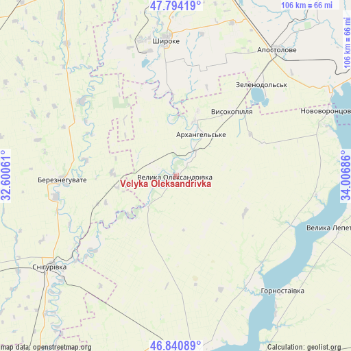
Velyka Oleksandrivka GPS coordinates[2]
47° 19' 10.884" North, 33° 18' 13.428" East
| Map corner | latitude | longitude |
|---|---|---|
| Upper-left | 47.79419°, | 32.60061° |
| Center: | 47.31969°, | 33.30373° |
| Lower-right: | 46.84089°, | 34.00686° |
| Map W x H: | 106×106 km | = 65.9×65.9mi |
| max Lat: | 52.18903° ⇑61.9% North |
| Velyka Oleksandrivka: | 47.31969° |
| min Lat: | ⇓38.1% South 44.39214° |
| min Long | Velyka Oleksand | max Long |
| 22.20555° | 33.30373° | 40.13222° |
| W 49.9%⇐ | ⇒50.1% E |
Elevation
Elevation of Velyka Oleksandrivka is 45 m = 148 ft, and this is 110.8 m = 364 ft below average elevation for this country.
| Max E: |
886 m = 2907 ft | 79.5% |
| Avg. | 155.8 m = 511 ft | |
| Velyka Oleksandrivka | 45 m = 148 ft | |
Min E: |
-3 m = -10 ft | 20.5% |
See also: Ukraine elevation on elevation.city.
Geographical zone
Velyka Oleksandrivka is located in North temperate zone (between Tropic of Cancer and the Arctic Circle). Distance of this North polar circle is 2139.7 km =1329.5 mi to North.| Distance of | km | miles | from Velyka Oleksandrivka |
|---|---|---|---|
| North Pole | 4745.6 | 2948.8 | to North |
| Arctic Circle | 2139.7 | 1329.5 | to North |
| Tropic Cancer | 2655.5 | 1650.1 | to South |
| Equator | 5261.5 | 3269.3 | to South |


Nearby cities:
15 places around Velyka Oleksandrivka: (largest is in red/bold)
• Apostolove
48.8 km =30.3 mi,  39°
39°
• Bereznehuvate
34.2 km =21.3 mi,  267°
267°
• Beryslav
54 km =33.6 mi,  169°
169°
• Dudchany
37.8 km =23.5 mi,  113°
113°
• Hornostayivka
47.3 km =29.4 mi,  137°
137°
• Kakhovka
57.9 km =36 mi, 166°
• Kayiry
51.6 km =32.1 mi, 143°
• Lyubymivka
60.1 km =37.3 mi,  160°
160°
• Malokakhovka
60.8 km =37.8 mi, 169°
• Nova Kakhovka
62.9 km =39.1 mi,  176°
176°
• Novovorontsovka
50.4 km =31.3 mi,  66°
66°
• Shyroke
41.5 km =25.8 mi,  355°
355°
• Snihurivka
46.4 km =28.8 mi,  234°
234°
• Velyka Lepetykha
50.9 km =31.6 mi, 108°
• Vysokopillya
25.7 km =16 mi, 41°
Sources, notices
• [Note1] Compared only with cities in Ukraine existing in our database
• [Src1] Map data: © OpenStreetMap contributors (CC-BY-SA)
• [Src2] Other city data from geonames.org with taken over terms of usage.
• [Src3] Geographical zone / Annual Mean Temperature by Robert A. Rohde @ Wikipedia
