Frontovoye geodata
Frontovoye (Sevastopol City) is a populated place; located in Ukraine in Europe/Simferopol (GMT+3) time zone. With population of 1,006 people, there are 1376 cities with bigger population in this country. Compared to other cities in Ukraine, 97.5% of cities are located further ↑North; 56.2% of cities are located further ←West and 67.7% of cities have higher elevation than Frontovoye. Note1
Administrative division(s):
- Level 1: Sevastopol City
- Level 2: Nakhimovskiy rayon
- Level 3: Verkhnesadovskiy munitsipal'niy okrug


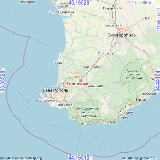
Frontovoye GPS coordinates[2]
44° 40' 2.532" North, 33° 44' 18.276" East
| Map corner | latitude | longitude |
|---|---|---|
| Upper-left | 45.16528°, | 33.03529° |
| Center: | 44.66737°, | 33.73841° |
| Lower-right: | 44.16515°, | 34.44154° |
| Map W x H: | 111.2×111.2 km | = 69.1×69.1mi |
| max Lat: | 52.18903° ⇑97.5% North |
| Frontovoye: | 44.66737° |
| min Lat: | ⇓2.5% South 44.39214° |
| min Long | Frontovoye | max Long |
| 22.20555° | 33.73841° | 40.13222° |
| W 56.2%⇐ | ⇒43.8% E |
Elevation
Elevation of Frontovoye is 82 m = 269 ft, and this is 73.8 m = 242 ft below average elevation for this country.
| Max E: |
886 m = 2907 ft | 67.7% |
| Avg. | 155.8 m = 511 ft | |
| Frontovoye | 82 m = 269 ft | |
Min E: |
-3 m = -10 ft | 32.3% |
See also: Ukraine elevation on elevation.city.
Geographical zone
Frontovoye is located in North temperate zone (between Tropic of Cancer and the Arctic Circle). Distance of this Northern Tropic circle is 2360.6 km =1466.8 mi to South.| Distance of | km | miles | from Frontovoye |
|---|---|---|---|
| North Pole | 5040.5 | 3132 | to North |
| Arctic Circle | 2434.6 | 1512.8 | to North |
| Tropic Cancer | 2360.6 | 1466.8 | to South |
| Equator | 4966.5 | 3086 | to South |


Nearby cities:
15 places around Frontovoye: (largest is in red/bold)
• Dolinnoye
10 km =6.2 mi,  18°
18°
• Fruktovoye
10.9 km =6.8 mi,  277°
277°
• Furmanovka
10.1 km =6.3 mi,  2°
2°
• Kholmovka
1.6 km =1 mi,  128°
128°
• Krasnyi Mak
4.4 km =2.7 mi, 129°
• Kuibyshevo
11.2 km =7 mi,  112°
112°
• Noven’koye
9.1 km =5.7 mi,  31°
31°
• Predushchel’noye
11.4 km =7.1 mi,  67°
67°
• Suvorovo
11.4 km =7.1 mi,  310°
310°
• Tankovoye
5.7 km =3.5 mi,  100°
100°
• Tenistoye
10.1 km =6.3 mi,  326°
326°
• Ternovka
9.9 km =6.2 mi,  174°
174°
• Turgenevka
8 km =5 mi, 65°
• Verkhnesadovoye
3.8 km =2.4 mi, 310°
• Zheleznodorozhnoye
7.6 km =4.7 mi,  43°
43°
Sources, notices
• [Note1] Compared only with cities in Ukraine existing in our database
• [Src1] Map data: © OpenStreetMap contributors (CC-BY-SA)
• [Src2] Other city data from geonames.org with taken over terms of usage.
• [Src3] Geographical zone / Annual Mean Temperature by Robert A. Rohde @ Wikipedia
