Dmitrovka geodata
Dmitrovka (Republic of Crimea) is a seat of a third-order administrative division; located in Ukraine in Europe/Simferopol (GMT+3) time zone. With population of 947 people, there are 1406 cities with bigger population in this country. Compared to other cities in Ukraine, 77.5% of cities are located further ↑North; 80.8% of cities are located further ←West and 98% of cities have higher elevation than Dmitrovka. Note1
Administrative division(s):
- Level 1: Republic of Crimea
- Level 2: Sovietskyi Raion
- Level 3: Dmitrovskoye sel'skoye poselenye


Dmitrovka GPS coordinates[2]
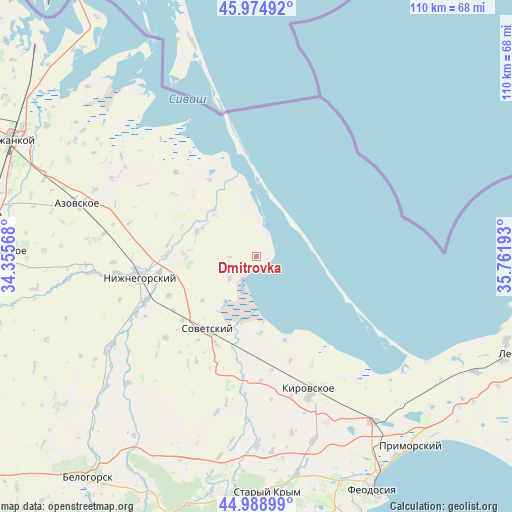
45° 29' 2.796" North, 35° 3' 31.68" East
| Map corner | latitude | longitude |
|---|---|---|
| Upper-left | 45.97492°, | 34.35568° |
| Center: | 45.48411°, | 35.0588° |
| Lower-right: | 44.98899°, | 35.76193° |
| Map W x H: | 109.6×109.6 km | = 68.1×68.1mi |
| max Lat: | 52.18903° ⇑77.5% North |
| Dmitrovka: | 45.48411° |
| min Lat: | ⇓22.5% South 44.39214° |
| min Long | Dmitrovka | max Long |
| 22.20555° | 35.0588° | 40.13222° |
| W 80.8%⇐ | ⇒19.2% E |
Elevation
Elevation of Dmitrovka is 7 m = 23 ft, and this is 148.8 m = 488 ft below average elevation for this country.
| Max E: |
886 m = 2907 ft | 98% |
| Avg. | 155.8 m = 511 ft | |
| Dmitrovka | 7 m = 23 ft | |
Min E: |
-3 m = -10 ft | 2% |
See also: Ukraine elevation on elevation.city.
Geographical zone
Dmitrovka is located in North temperate zone (between Tropic of Cancer and the Arctic Circle). Distance of this North polar circle is 2343.8 km =1456.4 mi to North.| Distance of | km | miles | from Dmitrovka |
|---|---|---|---|
| North Pole | 4949.7 | 3075.6 | to North |
| Arctic Circle | 2343.8 | 1456.4 | to North |
| Tropic Cancer | 2451.4 | 1523.2 | to South |
| Equator | 5057.4 | 3142.5 | to South |


Nearby cities:
15 places around Dmitrovka: (largest is in red/bold)
• Akimovka
18.7 km =11.6 mi,  282°
282°
• Chernozemnoye
20.5 km =12.7 mi,  245°
245°
• Izobil’noye
13.1 km =8.1 mi,  317°
317°
• Krasnoflotskoye
20.6 km =12.8 mi,  204°
204°
• Listvennoye
19.3 km =12 mi,  268°
268°
• Nekrasovka
7.5 km =4.7 mi,  229°
229°
• Novoivanovka
20.5 km =12.7 mi,  261°
261°
• Okhotskoye
15.2 km =9.4 mi, 270°
• Oktyabr’skoye
15 km =9.3 mi, 230°
• Razdol’noye
21 km =13 mi, 229°
• Sovetskiy
18.9 km =11.7 mi,  213°
213°
• Urozhaynoye
16.5 km =10.3 mi,  177°
177°
• Uvarovka
21.4 km =13.3 mi, 260°
• Varvarovka
21.8 km =13.5 mi, 214°
• Yemelyanovka
13.8 km =8.6 mi,  293°
293°
Sources, notices
• [Note1] Compared only with cities in Ukraine existing in our database
• [Src1] Map data: © OpenStreetMap contributors (CC-BY-SA)
• [Src2] Other city data from geonames.org with taken over terms of usage.
• [Src3] Geographical zone / Annual Mean Temperature by Robert A. Rohde @ Wikipedia
