Sovetskiy geodata
Sovetskiy (Republic of Crimea) is a seat of a second-order administrative division; located in Ukraine in Europe/Simferopol (GMT+3) time zone. With population of 10,410 people, there are 346 cities with bigger population in this country. Compared to other cities in Ukraine, 81.5% of cities are located further ↑North; 79.4% of cities are located further ←West and 91.7% of cities have higher elevation than Sovetskiy. Note1
Administrative division(s):
- Level 1: Republic of Crimea
- Level 2: Sovietskyi Raion
- Level 3: Sovetskoye sel'skoye poselenye


Sovetskiy GPS coordinates[2]
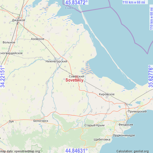
45° 20' 33.612" North, 34° 55' 28.668" East
| Map corner | latitude | longitude |
|---|---|---|
| Upper-left | 45.83472°, | 34.22151° |
| Center: | 45.34267°, | 34.92463° |
| Lower-right: | 44.84631°, | 35.62776° |
| Map W x H: | 109.9×109.9 km | = 68.3×68.3mi |
| max Lat: | 52.18903° ⇑81.5% North |
| Sovetskiy: | 45.34267° |
| min Lat: | ⇓18.5% South 44.39214° |
| min Long | Sovetskiy | max Long |
| 22.20555° | 34.92463° | 40.13222° |
| W 79.4%⇐ | ⇒20.6% E |
Elevation
Elevation of Sovetskiy is 17 m = 56 ft, and this is 138.8 m = 455 ft below average elevation for this country.
| Max E: |
886 m = 2907 ft | 91.7% |
| Avg. | 155.8 m = 511 ft | |
| Sovetskiy | 17 m = 56 ft | |
Min E: |
-3 m = -10 ft | 8.3% |
See also: Ukraine elevation on elevation.city.
Geographical zone
Sovetskiy is located in North temperate zone (between Tropic of Cancer and the Arctic Circle). Distance of this North polar circle is 2359.5 km =1466.1 mi to North.| Distance of | km | miles | from Sovetskiy |
|---|---|---|---|
| North Pole | 4965.4 | 3085.4 | to North |
| Arctic Circle | 2359.5 | 1466.1 | to North |
| Tropic Cancer | 2435.7 | 1513.5 | to South |
| Equator | 5041.6 | 3132.7 | to South |


Nearby cities:
15 places around Sovetskiy: (largest is in red/bold)
• Chapayevka
7.2 km =4.5 mi,  199°
199°
• Chernozemnoye
10.9 km =6.8 mi,  311°
311°
• Ilyichevo
15.8 km =9.8 mi,  133°
133°
• Krasnoflotskoye
3.5 km =2.2 mi,  149°
149°
• Nekrasovka
11.9 km =7.4 mi,  23°
23°
• Novy Mir
8.1 km =5 mi,  211°
211°
• Oktyabr’skoye
6.4 km =4 mi,  349°
349°
• Pchel’niki
12.2 km =7.6 mi,  244°
244°
• Pushkino
16 km =9.9 mi,  165°
165°
• Razdol’noye
5.8 km =3.6 mi,  291°
291°
• Urozhaynoye
11.3 km =7 mi,  93°
93°
• Varvarovka
3 km =1.9 mi,  223°
223°
• Vostochnoye
15.9 km =9.9 mi, 149°
• Zavetnoye
9.3 km =5.8 mi,  259°
259°
• Zhelyabovka
14.5 km =9 mi,  295°
295°
Sources, notices
• [Note1] Compared only with cities in Ukraine existing in our database
• [Src1] Map data: © OpenStreetMap contributors (CC-BY-SA)
• [Src2] Other city data from geonames.org with taken over terms of usage.
• [Src3] Geographical zone / Annual Mean Temperature by Robert A. Rohde @ Wikipedia
