Krasnoyarskoye geodata
Krasnoyarskoye (Republic of Crimea) is a seat of a third-order administrative division; located in Ukraine in Europe/Simferopol (GMT+3) time zone. With population of 626 people, there are 1568 cities with bigger population in this country. Compared to other cities in Ukraine, 76.8% of cities are located further ↑North; 50.7% of cities are located further →East and 88.6% of cities have higher elevation than Krasnoyarskoye. Note1
Administrative division(s):
- Level 1: Republic of Crimea
- Level 2: Chernomorskiy rayon
- Level 3: Krasnoyarskoye sel'skoye poselenye


Krasnoyarskoye GPS coordinates[2]
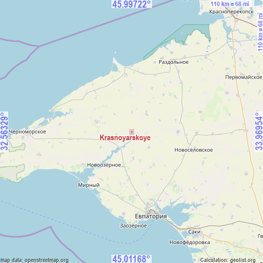
45° 30' 23.796" North, 33° 15' 59.076" East
| Map corner | latitude | longitude |
|---|---|---|
| Upper-left | 45.99722°, | 32.56329° |
| Center: | 45.50661°, | 33.26641° |
| Lower-right: | 45.01168°, | 33.96954° |
| Map W x H: | 109.6×109.6 km | = 68.1×68.1mi |
| max Lat: | 52.18903° ⇑76.8% North |
| Krasnoyarskoye: | 45.50661° |
| min Lat: | ⇓23.2% South 44.39214° |
| min Long | Krasnoyarskoye | max Long |
| 22.20555° | 33.26641° | 40.13222° |
| W 49.3%⇐ | ⇒50.7% E |
Elevation
Elevation of Krasnoyarskoye is 21 m = 69 ft, and this is 134.8 m = 442 ft below average elevation for this country.
| Max E: |
886 m = 2907 ft | 88.6% |
| Avg. | 155.8 m = 511 ft | |
| Krasnoyarskoye | 21 m = 69 ft | |
Min E: |
-3 m = -10 ft | 11.4% |
See also: Ukraine elevation on elevation.city.
Geographical zone
Krasnoyarskoye is located in North temperate zone (between Tropic of Cancer and the Arctic Circle). Distance of this North polar circle is 2341.3 km =1454.8 mi to North.| Distance of | km | miles | from Krasnoyarskoye |
|---|---|---|---|
| North Pole | 4947.2 | 3074 | to North |
| Arctic Circle | 2341.3 | 1454.8 | to North |
| Tropic Cancer | 2453.9 | 1524.8 | to South |
| Equator | 5059.9 | 3144.1 | to South |


Nearby cities:
15 places around Krasnoyarskoye: (largest is in red/bold)
• Berezovka
9.7 km =6 mi,  38°
38°
• Dalekoye
22.4 km =13.9 mi,  319°
319°
• Dobrushino
16.6 km =10.3 mi,  152°
152°
• Kirovskoye
15.3 km =9.5 mi,  286°
286°
• Natashino
10.9 km =6.8 mi,  177°
177°
• Niva
8.3 km =5.2 mi,  0°
0°
• Novoivanovka
14.6 km =9.1 mi,  244°
244°
• Novoozyornoye
18 km =11.2 mi,  220°
220°
• Orlovka
19.9 km =12.4 mi,  24°
24°
• Serebryanka
23.2 km =14.4 mi,  50°
50°
• Shishkino
22.2 km =13.8 mi,  192°
192°
• Veselovka
14.9 km =9.3 mi,  195°
195°
• Vorobyovo
19.8 km =12.3 mi, 184°
• Yelizavetovo
9.5 km =5.9 mi,  131°
131°
• Zimino
19.3 km =12 mi,  89°
89°
Sources, notices
• [Note1] Compared only with cities in Ukraine existing in our database
• [Src1] Map data: © OpenStreetMap contributors (CC-BY-SA)
• [Src2] Other city data from geonames.org with taken over terms of usage.
• [Src3] Geographical zone / Annual Mean Temperature by Robert A. Rohde @ Wikipedia
