Berezyne geodata
Berezyne (Odesa) is a populated place; located in Ukraine in Europe/Kiev (GMT+3) time zone. With population of 3,658 people, there are 804 cities with bigger population in this country. Compared to other cities in Ukraine, 68.4% of cities are located further ↑North; 71.8% of cities are located further →East and 81% of cities have higher elevation than Berezyne. Note1


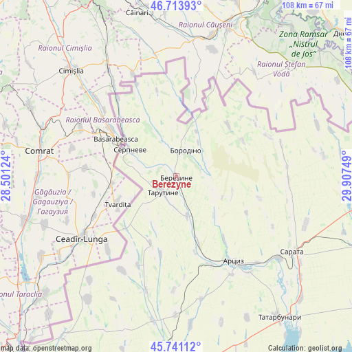
Berezyne GPS coordinates[2]
46° 13' 46.848" North, 29° 12' 15.696" East
| Map corner | latitude | longitude |
|---|---|---|
| Upper-left | 46.71393°, | 28.50124° |
| Center: | 46.22968°, | 29.20436° |
| Lower-right: | 45.74112°, | 29.90749° |
| Map W x H: | 108.2×108.2 km | = 67.2×67.2mi |
| max Lat: | 52.18903° ⇑68.4% North |
| Berezyne: | 46.22968° |
| min Lat: | ⇓31.6% South 44.39214° |
| min Long | Berezyne | max Long |
| 22.20555° | 29.20436° | 40.13222° |
| W 28.2%⇐ | ⇒71.8% E |
Elevation
Elevation of Berezyne is 40 m = 131 ft, and this is 115.8 m = 380 ft below average elevation for this country.
| Max E: |
886 m = 2907 ft | 81% |
| Avg. | 155.8 m = 511 ft | |
| Berezyne | 40 m = 131 ft | |
Min E: |
-3 m = -10 ft | 19% |
See also: Ukraine elevation on elevation.city.
Geographical zone
Berezyne is located in North temperate zone (between Tropic of Cancer and the Arctic Circle). Distance of this North polar circle is 2260.9 km =1404.9 mi to North.| Distance of | km | miles | from Berezyne |
|---|---|---|---|
| North Pole | 4866.8 | 3024.1 | to North |
| Arctic Circle | 2260.9 | 1404.9 | to North |
| Tropic Cancer | 2534.3 | 1574.7 | to South |
| Equator | 5140.3 | 3194 | to South |


Nearby cities:
15 places around Berezyne: (largest is in red/bold)
• Artsyz
31.2 km =19.4 mi,  148°
148°
• Borodino
8.6 km =5.3 mi,  19°
19°
• Dmytrivka
33.2 km =20.6 mi,  210°
210°
• Horodnye
46.6 km =29 mi,  216°
216°
• Kalcheva
62.5 km =38.8 mi, 208°
• Kamyshevka Vtoraya
48.4 km =30.1 mi,  89°
89°
• Kulevcha
60.6 km =37.7 mi,  111°
111°
• Novi Troyany
41.7 km =25.9 mi, 220°
• Plakhtiyivka
42.3 km =26.3 mi, 109°
• Sarata
42.5 km =26.4 mi,  123°
123°
• Serpneve
16.3 km =10.1 mi,  299°
299°
• Starokozache
61.2 km =38 mi,  78°
78°
• Tarutyne
6.3 km =3.9 mi, 219°
• Tatarbunary
53.9 km =33.5 mi,  144°
144°
• Zorya
46.3 km =28.8 mi, 124°
Sources, notices
• [Note1] Compared only with cities in Ukraine existing in our database
• [Src1] Map data: © OpenStreetMap contributors (CC-BY-SA)
• [Src2] Other city data from geonames.org with taken over terms of usage.
• [Src3] Geographical zone / Annual Mean Temperature by Robert A. Rohde @ Wikipedia
