Zorya geodata
Zorya (Odesa) is a populated place; located in Ukraine in Europe/Kiev (GMT+3) time zone. With population of 5,243 people, there are 624 cities with bigger population in this country. Compared to other cities in Ukraine, 69.9% of cities are located further ↑North; 69.2% of cities are located further →East and 92.2% of cities have higher elevation than Zorya. Note1


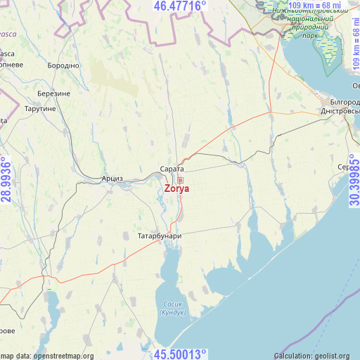
Zorya GPS coordinates[2]
45° 59' 26.88" North, 29° 41' 48.192" East
| Map corner | latitude | longitude |
|---|---|---|
| Upper-left | 46.47716°, | 28.9936° |
| Center: | 45.9908°, | 29.69672° |
| Lower-right: | 45.50013°, | 30.39985° |
| Map W x H: | 108.6×108.6 km | = 67.5×67.5mi |
| max Lat: | 52.18903° ⇑69.9% North |
| Zorya: | 45.9908° |
| min Lat: | ⇓30.1% South 44.39214° |
| min Long | Zorya | max Long |
| 22.20555° | 29.69672° | 40.13222° |
| W 30.8%⇐ | ⇒69.2% E |
Elevation
Elevation of Zorya is 16 m = 52 ft, and this is 139.8 m = 459 ft below average elevation for this country.
| Max E: |
886 m = 2907 ft | 92.2% |
| Avg. | 155.8 m = 511 ft | |
| Zorya | 16 m = 52 ft | |
Min E: |
-3 m = -10 ft | 7.8% |
See also: Ukraine elevation on elevation.city.
Geographical zone
Zorya is located in North temperate zone (between Tropic of Cancer and the Arctic Circle). Distance of this North polar circle is 2287.5 km =1421.4 mi to North.| Distance of | km | miles | from Zorya |
|---|---|---|---|
| North Pole | 4893.4 | 3040.6 | to North |
| Arctic Circle | 2287.5 | 1421.4 | to North |
| Tropic Cancer | 2507.8 | 1558.3 | to South |
| Equator | 5113.7 | 3177.5 | to South |


Nearby cities:
15 places around Zorya: (largest is in red/bold)
• Artsyz
21.5 km =13.4 mi,  270°
270°
• Berezyne
46.3 km =28.8 mi,  304°
304°
• Bilhorod-Dnistrovskyi
55.2 km =34.3 mi,  65°
65°
• Borodino
49.3 km =30.6 mi,  314°
314°
• Dmytrivka
54.9 km =34.1 mi, 267°
• Kamyshevka Vtoraya
28.9 km =18 mi,  21°
21°
• Kulevcha
19 km =11.8 mi,  76°
76°
• Plakhtiyivka
12.4 km =7.7 mi,  8°
8°
• Salhany
53.1 km =33 mi, 70°
• Sarata
4 km =2.5 mi,  323°
323°
• Serhiyivka
52.7 km =32.7 mi,  85°
85°
• Shabo
55.5 km =34.5 mi, 73°
• Starokozache
44.5 km =27.7 mi,  29°
29°
• Tarutyne
47.3 km =29.4 mi, 297°
• Tatarbunary
18.2 km =11.3 mi,  200°
200°
Sources, notices
• [Note1] Compared only with cities in Ukraine existing in our database
• [Src1] Map data: © OpenStreetMap contributors (CC-BY-SA)
• [Src2] Other city data from geonames.org with taken over terms of usage.
• [Src3] Geographical zone / Annual Mean Temperature by Robert A. Rohde @ Wikipedia
