Starokozache geodata
Starokozache (Odesa) is a populated place; located in Ukraine in Europe/Kiev (GMT+3) time zone. With population of 5,108 people, there are 641 cities with bigger population in this country. Compared to other cities in Ukraine, 67.9% of cities are located further ↑North; 67.9% of cities are located further →East and 68.7% of cities have higher elevation than Starokozache. Note1


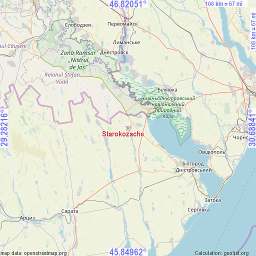
Starokozache GPS coordinates[2]
46° 20' 13.992" North, 29° 59' 7.008" East
| Map corner | latitude | longitude |
|---|---|---|
| Upper-left | 46.82051°, | 29.28216° |
| Center: | 46.33722°, | 29.98528° |
| Lower-right: | 45.84962°, | 30.68841° |
| Map W x H: | 108×108 km | = 67.1×67.1mi |
| max Lat: | 52.18903° ⇑67.9% North |
| Starokozache: | 46.33722° |
| min Lat: | ⇓32.1% South 44.39214° |
| min Long | Starokozache | max Long |
| 22.20555° | 29.98528° | 40.13222° |
| W 32.1%⇐ | ⇒67.9% E |
Elevation
Elevation of Starokozache is 78 m = 256 ft, and this is 77.8 m = 255 ft below average elevation for this country.
| Max E: |
886 m = 2907 ft | 68.7% |
| Avg. | 155.8 m = 511 ft | |
| Starokozache | 78 m = 256 ft | |
Min E: |
-3 m = -10 ft | 31.3% |
See also: Ukraine elevation on elevation.city.
Geographical zone
Starokozache is located in North temperate zone (between Tropic of Cancer and the Arctic Circle). Distance of this North polar circle is 2249 km =1397.5 mi to North.| Distance of | km | miles | from Starokozache |
|---|---|---|---|
| North Pole | 4854.8 | 3016.6 | to North |
| Arctic Circle | 2249 | 1397.5 | to North |
| Tropic Cancer | 2546.3 | 1582.2 | to South |
| Equator | 5152.2 | 3201.4 | to South |


Nearby cities:
15 places around Starokozache: (largest is in red/bold)
• Bilhorod-Dnistrovskyi
32.1 km =19.9 mi,  119°
119°
• Bilyayivka
24.1 km =15 mi,  47°
47°
• Kamyshevka Vtoraya
16.4 km =10.2 mi,  225°
225°
• Kulevcha
34.3 km =21.3 mi,  186°
186°
• Lymanske
35.4 km =22 mi,  357°
357°
• Mayaky
23.9 km =14.9 mi,  68°
68°
• Ovidiopol
36.4 km =22.6 mi,  105°
105°
• Plakhtiyivka
33.2 km =20.6 mi,  217°
217°
• Salhany
34.8 km =21.6 mi,  127°
127°
• Sarata
43 km =26.7 mi,  214°
214°
• Serhiyivka
45.8 km =28.5 mi,  138°
138°
• Shabo
38.3 km =23.8 mi, 126°
• Stepove
41.4 km =25.7 mi,  9°
9°
• Teplodar
32.1 km =19.9 mi, 54°
• Zorya
44.5 km =27.7 mi, 209°
Sources, notices
• [Note1] Compared only with cities in Ukraine existing in our database
• [Src1] Map data: © OpenStreetMap contributors (CC-BY-SA)
• [Src2] Other city data from geonames.org with taken over terms of usage.
• [Src3] Geographical zone / Annual Mean Temperature by Robert A. Rohde @ Wikipedia
