Kamyshevka Vtoraya geodata
Kamyshevka Vtoraya (Odesa) is a populated place; located in Ukraine in Europe/Kiev (GMT+3) time zone. With population of 3,352 people, there are 858 cities with bigger population in this country. Compared to other cities in Ukraine, 68.4% of cities are located further ↑North; 68.7% of cities are located further →East and 78.7% of cities have higher elevation than Kamyshevka Vtoraya. Note1


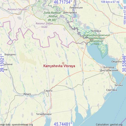
Kamyshevka Vtoraya GPS coordinates[2]
46° 13' 59.988" North, 29° 49' 59.988" East
| Map corner | latitude | longitude |
|---|---|---|
| Upper-left | 46.71754°, | 29.13021° |
| Center: | 46.23333°, | 29.83333° |
| Lower-right: | 45.74481°, | 30.53646° |
| Map W x H: | 108.2×108.2 km | = 67.2×67.2mi |
| max Lat: | 52.18903° ⇑68.4% North |
| Kamyshevka Vtoraya: | 46.23333° |
| min Lat: | ⇓31.6% South 44.39214° |
| min Long | Kamyshevka Vtor | max Long |
| 22.20555° | 29.83333° | 40.13222° |
| W 31.3%⇐ | ⇒68.7% E |
Elevation
Elevation of Kamyshevka Vtoraya is 48 m = 157 ft, and this is 107.8 m = 354 ft below average elevation for this country.
| Max E: |
886 m = 2907 ft | 78.7% |
| Avg. | 155.8 m = 511 ft | |
| Kamyshevka Vtoraya | 48 m = 157 ft | |
Min E: |
-3 m = -10 ft | 21.3% |
See also: Ukraine elevation on elevation.city.
Geographical zone
Kamyshevka Vtoraya is located in North temperate zone (between Tropic of Cancer and the Arctic Circle). Distance of this North polar circle is 2260.5 km =1404.6 mi to North.| Distance of | km | miles | from Kamyshevka Vtoraya |
|---|---|---|---|
| North Pole | 4866.4 | 3023.8 | to North |
| Arctic Circle | 2260.5 | 1404.6 | to North |
| Tropic Cancer | 2534.7 | 1575 | to South |
| Equator | 5140.7 | 3194.3 | to South |


Nearby cities:
15 places around Kamyshevka Vtoraya: (largest is in red/bold)
• Artsyz
41.8 km =26 mi,  230°
230°
• Bilhorod-Dnistrovskyi
39.9 km =24.8 mi,  96°
96°
• Bilyayivka
40.5 km =25.2 mi,  46°
46°
• Borodino
46.1 km =28.6 mi,  279°
279°
• Kulevcha
23.9 km =14.9 mi,  160°
160°
• Mayaky
39.6 km =24.6 mi,  58°
58°
• Ovidiopol
46.8 km =29.1 mi,  87°
87°
• Plakhtiyivka
17.1 km =10.6 mi,  210°
210°
• Salhany
40.6 km =25.2 mi, 103°
• Sarata
27 km =16.8 mi, 208°
• Serhiyivka
47.7 km =29.6 mi,  118°
118°
• Shabo
44 km =27.3 mi, 104°
• Starokozache
16.4 km =10.2 mi, 45°
• Tatarbunary
47.2 km =29.3 mi,  201°
201°
• Zorya
28.9 km =18 mi, 201°
Sources, notices
• [Note1] Compared only with cities in Ukraine existing in our database
• [Src1] Map data: © OpenStreetMap contributors (CC-BY-SA)
• [Src2] Other city data from geonames.org with taken over terms of usage.
• [Src3] Geographical zone / Annual Mean Temperature by Robert A. Rohde @ Wikipedia
