Lugazi geodata
Lugazi (Central Region) is a populated place; located in Uganda in Africa/Kampala (GMT+3) time zone. With population of 35,036 people, there are 22 cities with bigger population in this country. Compared to other cities in Uganda, 67.1% of cities are located further ↑North; 63.7% of cities are located further ←West and 56.8% of cities have lower elevation than Lugazi. Note1
Administrative division(s):
- Level 1: Central Region
- Level 2: Buikwe District
- Level 3: Buikwe
- Level 4: Lugazi Town Council


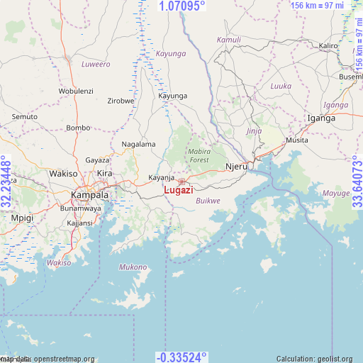
Lugazi GPS coordinates[2]
0° 22' 4.368" North, 32° 56' 15.36" East
| Map corner | latitude | longitude |
|---|---|---|
| Upper-left | 1.07095°, | 32.23448° |
| Center: | 0.36788°, | 32.9376° |
| Lower-right: | -0.33524°, | 33.64073° |
| Map W x H: | 156.4×156.4 km | = 97.2×97.2mi |
| max Lat: | 3.66088° ⇑67.1% North |
| Lugazi: | 0.36788° |
| min Lat: | ⇓32.9% South -1.28538° |
| min Long | Lugazi | max Long |
| 29.65° | 32.9376° | 34.95° |
| W 63.7%⇐ | ⇒36.3% E |
Elevation
Elevation of Lugazi is 1208 m = 3963 ft, and this is 51 m = 167 ft below average elevation for this country.
| Max E: |
4129 m = 13547 ft | 43.2% |
| Avg. | 1259 m = 4131 ft | |
| Lugazi | 1208 m = 3963 ft | |
Min E: |
622 m = 2041 ft | 56.8% |
See also: Uganda elevation on elevation.city.
Geographical zone
Lugazi is located in North Torrid zone (between Equator and Tropic of Cancer). Distance of Equator is 40.9 km =25.4 mi to South.| Distance of | km | miles | from Lugazi |
|---|---|---|---|
| North Pole | 9966.2 | 6192.7 | to North |
| Arctic Circle | 7360.3 | 4573.5 | to North |
| Tropic Cancer | 2565 | 1593.8 | to North |
| Equator | 40.9 | 25.4 | to South |


Nearby cities:
15 places around Lugazi: (largest is in red/bold)
• Bugembe
36 km =22.4 mi,  69°
69°
• Buikwe
8.8 km =5.5 mi,  112°
112°
• Buwenge
40.7 km =25.3 mi,  39°
39°
• Bweyogerere
30.5 km =19 mi,  267°
267°
• Gombe
52.6 km =32.7 mi,  284°
284°
• Jinja
30.6 km =19 mi,  75°
75°
• Kajansi
47.9 km =29.8 mi,  249°
249°
• Kampala
39.9 km =24.8 mi,  261°
261°
• Kampala Central Division
40.6 km =25.2 mi, 263°
• Kayunga
37.6 km =23.4 mi,  351°
351°
• Kireka
32.1 km =19.9 mi, 265°
• Kitamilo
34 km =21.1 mi,  118°
118°
• Lweeza
42.9 km =26.7 mi, 245°
• Mukono
20.3 km =12.6 mi, 265°
• Njeru
28.1 km =17.5 mi, 73°
Sources, notices
• [Note1] Compared only with cities in Uganda existing in our database
• [Src1] Map data: © OpenStreetMap contributors (CC-BY-SA)
• [Src2] Other city data from geonames.org with taken over terms of usage.
• [Src3] Geographical zone / Annual Mean Temperature by Robert A. Rohde @ Wikipedia
