Brookwood geodata
Brookwood (Alabama) is a populated place; located in United States in America/Chicago (GMT-5) time zone. With population of 1,822 people, there are 12466 cities with bigger population in this country. Compared to other cities in United States, 84.1% of cities are located further ↑North; 50.4% of cities are located further →East and 53.9% of cities have higher elevation than Brookwood. Note1


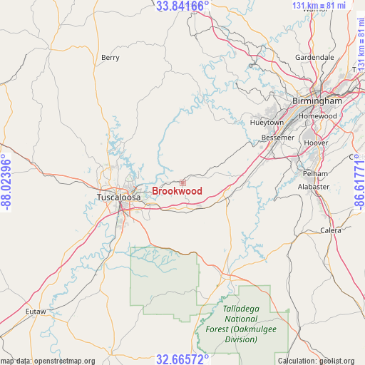
Brookwood GPS coordinates[2]
33° 15' 20.412" North, 87° 19' 14.988" West
| Map corner | latitude | longitude |
|---|---|---|
| Upper-left | 33.84166°, | -88.02396° |
| Center: | 33.25567°, | -87.32083° |
| Lower-right: | 32.66572°, | -86.61771° |
| Map W x H: | 130.8×130.8 km | = 81.3×81.3mi |
| max Lat: | 71.29058° ⇑84.1% North |
| Brookwood: | 33.25567° |
| min Lat: | ⇓15.9% South 19.06759° |
| min Long | Brookwood | max Long |
| -171.73463° | -87.32083° | -66.98998° |
| W 49.6%⇐ | ⇒50.4% E |
Elevation
Elevation of Brookwood is 184 m = 604 ft, and this is 110.8 m = 364 ft below average elevation for this country.
| Max E: |
3189 m = 10463 ft | 53.9% |
| Avg. | 294.8 m = 967 ft | |
| Brookwood | 184 m = 604 ft | |
Min E: |
-60 m = -197 ft | 46.1% |
See also: United States elevation on elevation.city.
Geographical zone
Brookwood is located in North temperate zone (between Tropic of Cancer and the Arctic Circle). Distance of this Northern Tropic circle is 1091.8 km =678.4 mi to South.| Distance of | km | miles | from Brookwood |
|---|---|---|---|
| North Pole | 6309.4 | 3920.5 | to North |
| Arctic Circle | 3703.5 | 2301.2 | to North |
| Tropic Cancer | 1091.8 | 678.4 | to South |
| Equator | 3697.7 | 2297.6 | to South |


Nearby cities:
15 places around Brookwood: (largest is in red/bold)
• Bessemer
37.7 km =23.4 mi,  64°
64°
• Brent
38.3 km =23.8 mi,  157°
157°
• Coaling
10.9 km =6.8 mi,  189°
189°
• Coker
34.1 km =21.2 mi,  268°
268°
• Concord
35.8 km =22.2 mi,  48°
48°
• Holt
15.4 km =9.6 mi,  261°
261°
• Hueytown
37.1 km =23.1 mi, 54°
• Lake View
17.3 km =10.7 mi,  80°
80°
• North Bibb
16.6 km =10.3 mi,  110°
110°
• Northport
24 km =14.9 mi, 262°
• Rock Creek
33.2 km =20.6 mi,  42°
42°
• Tuscaloosa
23.7 km =14.7 mi, 257°
• Vance
12.2 km =7.6 mi,  138°
138°
• West Blocton
23.8 km =14.8 mi,  129°
129°
• Woodstock
16.8 km =10.4 mi, 108°
Sources, notices
• [Note1] Compared only with cities in United States existing in our database
• [Src1] Map data: © OpenStreetMap contributors (CC-BY-SA)
• [Src2] Other city data from geonames.org with taken over terms of usage.
• [Src3] Geographical zone / Annual Mean Temperature by Robert A. Rohde @ Wikipedia
