Carrollton geodata
Carrollton (Alabama) is a seat of a second-order administrative division; located in United States in America/Chicago (GMT-5) time zone. With population of 988 people, there are 16360 cities with bigger population in this country. Compared to other cities in United States, 84.1% of cities are located further ↑North; 53.3% of cities are located further →East and 74.4% of cities have higher elevation than Carrollton. Note1


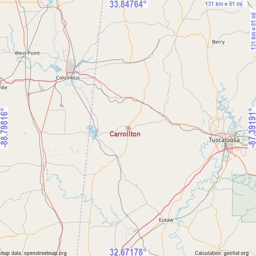
Carrollton GPS coordinates[2]
33° 15' 42.084" North, 88° 5' 42.108" West
| Map corner | latitude | longitude |
|---|---|---|
| Upper-left | 33.84764°, | -88.79816° |
| Center: | 33.26169°, | -88.09503° |
| Lower-right: | 32.67178°, | -87.39191° |
| Map W x H: | 130.7×130.7 km | = 81.2×81.2mi |
| max Lat: | 71.29058° ⇑84.1% North |
| Carrollton: | 33.26169° |
| min Lat: | ⇓15.9% South 19.06759° |
| min Long | Carrollton | max Long |
| -171.73463° | -88.09503° | -66.98998° |
| W 46.7%⇐ | ⇒53.3% E |
Elevation
Elevation of Carrollton is 75 m = 246 ft, and this is 219.8 m = 721 ft below average elevation for this country.
| Max E: |
3189 m = 10463 ft | 74.4% |
| Avg. | 294.8 m = 967 ft | |
| Carrollton | 75 m = 246 ft | |
Min E: |
-60 m = -197 ft | 25.6% |
See also: United States elevation on elevation.city.
Geographical zone
Carrollton is located in North temperate zone (between Tropic of Cancer and the Arctic Circle). Distance of this Northern Tropic circle is 1092.4 km =678.8 mi to South.| Distance of | km | miles | from Carrollton |
|---|---|---|---|
| North Pole | 6308.7 | 3920 | to North |
| Arctic Circle | 3702.8 | 2300.8 | to North |
| Tropic Cancer | 1092.4 | 678.8 | to South |
| Equator | 3698.4 | 2298.1 | to South |


Nearby cities:
15 places around Carrollton: (largest is in red/bold)
• Aliceville
15.6 km =9.7 mi,  199°
199°
• Brooksville
45.4 km =28.2 mi,  266°
266°
• Caledonia
51.4 km =31.9 mi,  335°
335°
• Coker
37.9 km =23.5 mi,  92°
92°
• Columbus
40.4 km =25.1 mi,  310°
310°
• Crawford
48.5 km =30.1 mi,  275°
275°
• Eutaw
50.7 km =31.5 mi,  157°
157°
• Gordo
19 km =11.8 mi,  70°
70°
• Macon
46.7 km =29 mi,  248°
248°
• Millport
33.6 km =20.9 mi,  2°
2°
• New Hope
31.5 km =19.6 mi,  316°
316°
• Northport
48.3 km =30 mi, 94°
• Pickensville
16.4 km =10.2 mi,  256°
256°
• Reform
14.9 km =9.3 mi,  29°
29°
• Tuscaloosa
49.2 km =30.6 mi,  96°
96°
Sources, notices
• [Note1] Compared only with cities in United States existing in our database
• [Src1] Map data: © OpenStreetMap contributors (CC-BY-SA)
• [Src2] Other city data from geonames.org with taken over terms of usage.
• [Src3] Geographical zone / Annual Mean Temperature by Robert A. Rohde @ Wikipedia
