Guntersville geodata
Guntersville (Alabama) is a seat of a second-order administrative division; located in United States in America/Chicago (GMT-5) time zone. With population of 8,385 people, there are 5086 cities with bigger population in this country. Compared to other cities in United States, 78.2% of cities are located further ↑North; 52.1% of cities are located further ←West and 50.5% of cities have higher elevation than Guntersville. Note1


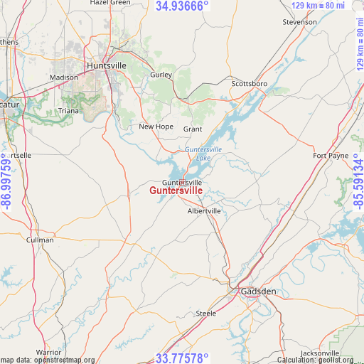
Guntersville GPS coordinates[2]
34° 21' 29.628" North, 86° 17' 40.056" West
| Map corner | latitude | longitude |
|---|---|---|
| Upper-left | 34.93666°, | -86.99759° |
| Center: | 34.35823°, | -86.29446° |
| Lower-right: | 33.77578°, | -85.59134° |
| Map W x H: | 129.1×129.1 km | = 80.2×80.2mi |
| max Lat: | 71.29058° ⇑78.2% North |
| Guntersville: | 34.35823° |
| min Lat: | ⇓21.8% South 19.06759° |
| min Long | Guntersville | max Long |
| -171.73463° | -86.29446° | -66.98998° |
| W 52.1%⇐ | ⇒47.9% E |
Elevation
Elevation of Guntersville is 196 m = 643 ft, and this is 98.8 m = 324 ft below average elevation for this country.
| Max E: |
3189 m = 10463 ft | 50.5% |
| Avg. | 294.8 m = 967 ft | |
| Guntersville | 196 m = 643 ft | |
Min E: |
-60 m = -197 ft | 49.5% |
See also: United States elevation on elevation.city.
Geographical zone
Guntersville is located in North temperate zone (between Tropic of Cancer and the Arctic Circle). Distance of this Northern Tropic circle is 1214.4 km =754.6 mi to South.| Distance of | km | miles | from Guntersville |
|---|---|---|---|
| North Pole | 6186.8 | 3844.3 | to North |
| Arctic Circle | 3580.9 | 2225.1 | to North |
| Tropic Cancer | 1214.4 | 754.6 | to South |
| Equator | 3820.3 | 2373.8 | to South |


Nearby cities:
15 places around Guntersville: (largest is in red/bold)
• Albertville
12.8 km =8 mi,  141°
141°
• Arab
19 km =11.8 mi,  256°
256°
• Baileyton
31.1 km =19.3 mi,  249°
249°
• Boaz
21.1 km =13.1 mi,  146°
146°
• Crossville
28.7 km =17.8 mi,  105°
105°
• Douglas
20.7 km =12.9 mi,  187°
187°
• Geraldine
27 km =16.8 mi,  91°
91°
• Grant
19.3 km =12 mi,  11°
11°
• Joppa
24.9 km =15.5 mi, 254°
• New Hope
21.9 km =13.6 mi,  335°
335°
• Owens Cross Roads
29.7 km =18.5 mi,  329°
329°
• Sardis City
25.8 km =16 mi, 142°
• Snead
28.1 km =17.5 mi,  199°
199°
• Whitesboro
29.9 km =18.6 mi, 136°
• Woodville
30 km =18.6 mi,  3°
3°
Sources, notices
• [Note1] Compared only with cities in United States existing in our database
• [Src1] Map data: © OpenStreetMap contributors (CC-BY-SA)
• [Src2] Other city data from geonames.org with taken over terms of usage.
• [Src3] Geographical zone / Annual Mean Temperature by Robert A. Rohde @ Wikipedia
