Maplesville geodata
Maplesville (Alabama) is a populated place; located in United States in America/Chicago (GMT-5) time zone. With population of 704 people, there are 18635 cities with bigger population in this country. Compared to other cities in United States, 86% of cities are located further ↑North; 50.6% of cities are located further ←West and 66.7% of cities have higher elevation than Maplesville. Note1


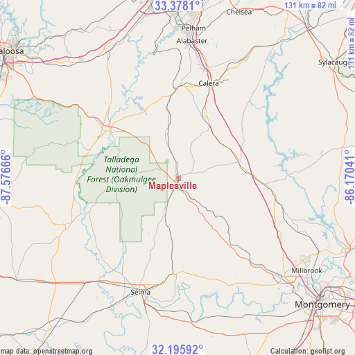
Maplesville GPS coordinates[2]
32° 47' 20.292" North, 86° 52' 24.708" West
| Map corner | latitude | longitude |
|---|---|---|
| Upper-left | 33.3781°, | -87.57666° |
| Center: | 32.78897°, | -86.87353° |
| Lower-right: | 32.19592°, | -86.17041° |
| Map W x H: | 131.4×131.4 km | = 81.6×81.6mi |
| max Lat: | 71.29058° ⇑86% North |
| Maplesville: | 32.78897° |
| min Lat: | ⇓14% South 19.06759° |
| min Long | Maplesville | max Long |
| -171.73463° | -86.87353° | -66.98998° |
| W 50.6%⇐ | ⇒49.4% E |
Elevation
Elevation of Maplesville is 119 m = 390 ft, and this is 175.8 m = 577 ft below average elevation for this country.
| Max E: |
3189 m = 10463 ft | 66.7% |
| Avg. | 294.8 m = 967 ft | |
| Maplesville | 119 m = 390 ft | |
Min E: |
-60 m = -197 ft | 33.3% |
See also: United States elevation on elevation.city.
Geographical zone
Maplesville is located in North temperate zone (between Tropic of Cancer and the Arctic Circle). Distance of this Northern Tropic circle is 1039.9 km =646.2 mi to South.| Distance of | km | miles | from Maplesville |
|---|---|---|---|
| North Pole | 6361.3 | 3952.7 | to North |
| Arctic Circle | 3755.4 | 2333.5 | to North |
| Tropic Cancer | 1039.9 | 646.2 | to South |
| Equator | 3645.8 | 2265.4 | to South |


Nearby cities:
15 places around Maplesville: (largest is in red/bold)
• Autaugaville
44.5 km =27.7 mi,  152°
152°
• Brent
31.8 km =19.8 mi,  301°
301°
• Calera
36.7 km =22.8 mi,  17°
17°
• Centreville
28.7 km =17.8 mi,  307°
307°
• Clanton
23.5 km =14.6 mi,  76°
76°
• Jemison
22.4 km =13.9 mi,  31°
31°
• Marbury
38.9 km =24.2 mi,  104°
104°
• Montevallo
34.7 km =21.6 mi,  1°
1°
• Pine Level
44.5 km =27.7 mi,  120°
120°
• Selma
44.6 km =27.7 mi,  198°
198°
• Shelby
44.8 km =27.8 mi,  37°
37°
• Thorsby
20.4 km =12.7 mi,  46°
46°
• Valley Grande
32.9 km =20.4 mi, 198°
• West Blocton
43.5 km =27 mi,  327°
327°
• Wilton
32.2 km =20 mi,  358°
358°
Sources, notices
• [Note1] Compared only with cities in United States existing in our database
• [Src1] Map data: © OpenStreetMap contributors (CC-BY-SA)
• [Src2] Other city data from geonames.org with taken over terms of usage.
• [Src3] Geographical zone / Annual Mean Temperature by Robert A. Rohde @ Wikipedia
