Marion geodata
Marion (Alabama) is a seat of a second-order administrative division; located in United States in America/Chicago (GMT-5) time zone. With population of 3,447 people, there are 8915 cities with bigger population in this country. Compared to other cities in United States, 86.6% of cities are located further ↑North; 50.4% of cities are located further →East and 67.3% of cities have higher elevation than Marion. Note1


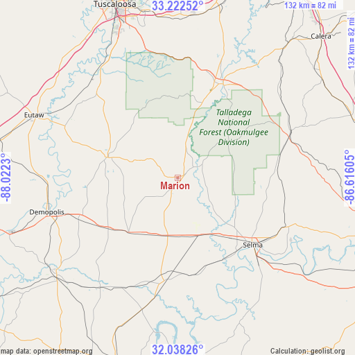
Marion GPS coordinates[2]
32° 37' 56.46" North, 87° 19' 9.012" West
| Map corner | latitude | longitude |
|---|---|---|
| Upper-left | 33.22252°, | -88.0223° |
| Center: | 32.63235°, | -87.31917° |
| Lower-right: | 32.03826°, | -86.61605° |
| Map W x H: | 131.7×131.7 km | = 81.8×81.8mi |
| max Lat: | 71.29058° ⇑86.6% North |
| Marion: | 32.63235° |
| min Lat: | ⇓13.4% South 19.06759° |
| min Long | Marion | max Long |
| -171.73463° | -87.31917° | -66.98998° |
| W 49.6%⇐ | ⇒50.4% E |
Elevation
Elevation of Marion is 116 m = 381 ft, and this is 178.8 m = 587 ft below average elevation for this country.
| Max E: |
3189 m = 10463 ft | 67.3% |
| Avg. | 294.8 m = 967 ft | |
| Marion | 116 m = 381 ft | |
Min E: |
-60 m = -197 ft | 32.7% |
See also: United States elevation on elevation.city.
Geographical zone
Marion is located in North temperate zone (between Tropic of Cancer and the Arctic Circle). Distance of this Northern Tropic circle is 1022.5 km =635.4 mi to South.| Distance of | km | miles | from Marion |
|---|---|---|---|
| North Pole | 6378.7 | 3963.5 | to North |
| Arctic Circle | 3772.8 | 2344.3 | to North |
| Tropic Cancer | 1022.5 | 635.4 | to South |
| Equator | 3628.4 | 2254.6 | to South |


Nearby cities:
15 places around Marion: (largest is in red/bold)
• Brent
36.9 km =22.9 mi,  23°
23°
• Centreville
39.7 km =24.7 mi,  28°
28°
• Coaling
58.6 km =36.4 mi,  358°
358°
• Demopolis
50.1 km =31.1 mi,  255°
255°
• Eutaw
58 km =36 mi,  293°
293°
• Forkland
52.9 km =32.9 mi,  271°
271°
• Greensboro
27.1 km =16.8 mi, 287°
• Linden
57.7 km =35.9 mi,  231°
231°
• Maplesville
45.2 km =28.1 mi,  67°
67°
• Moundville
49.9 km =31 mi,  324°
324°
• Selma
37.5 km =23.3 mi,  131°
131°
• Selmont-West Selmont
40.6 km =25.2 mi, 134°
• Uniontown
27.3 km =17 mi,  221°
221°
• Valley Grande
34 km =21.1 mi,  113°
113°
• West Blocton
57 km =35.4 mi, 18°
Sources, notices
• [Note1] Compared only with cities in United States existing in our database
• [Src1] Map data: © OpenStreetMap contributors (CC-BY-SA)
• [Src2] Other city data from geonames.org with taken over terms of usage.
• [Src3] Geographical zone / Annual Mean Temperature by Robert A. Rohde @ Wikipedia
