Riverside geodata
Riverside (Alabama) is a populated place; located in United States in America/Chicago (GMT-5) time zone. With population of 2,300 people, there are 11077 cities with bigger population in this country. Compared to other cities in United States, 82.6% of cities are located further ↑North; 52.3% of cities are located further ←West and 61.7% of cities have higher elevation than Riverside. Note1


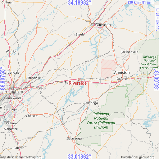
Riverside GPS coordinates[2]
33° 36' 22.356" North, 86° 12' 15.912" West
| Map corner | latitude | longitude |
|---|---|---|
| Upper-left | 34.18982°, | -86.90755° |
| Center: | 33.60621°, | -86.20442° |
| Lower-right: | 33.01862°, | -85.5013° |
| Map W x H: | 130.2×130.2 km | = 80.9×80.9mi |
| max Lat: | 71.29058° ⇑82.6% North |
| Riverside: | 33.60621° |
| min Lat: | ⇓17.4% South 19.06759° |
| min Long | Riverside | max Long |
| -171.73463° | -86.20442° | -66.98998° |
| W 52.3%⇐ | ⇒47.7% E |
Elevation
Elevation of Riverside is 146 m = 479 ft, and this is 148.8 m = 488 ft below average elevation for this country.
| Max E: |
3189 m = 10463 ft | 61.7% |
| Avg. | 294.8 m = 967 ft | |
| Riverside | 146 m = 479 ft | |
Min E: |
-60 m = -197 ft | 38.3% |
See also: United States elevation on elevation.city.
Geographical zone
Riverside is located in North temperate zone (between Tropic of Cancer and the Arctic Circle). Distance of this Northern Tropic circle is 1130.7 km =702.6 mi to South.| Distance of | km | miles | from Riverside |
|---|---|---|---|
| North Pole | 6270.4 | 3896.2 | to North |
| Arctic Circle | 3664.5 | 2277 | to North |
| Tropic Cancer | 1130.7 | 702.6 | to South |
| Equator | 3736.7 | 2321.9 | to South |


Nearby cities:
15 places around Riverside: (largest is in red/bold)
• Argo
28.9 km =18 mi,  288°
288°
• Ashville
26.1 km =16.2 mi,  349°
349°
• Branchville
20.9 km =13 mi,  299°
299°
• Bynum
22.5 km =14 mi,  88°
88°
• Lincoln
8 km =5 mi,  84°
84°
• Margaret
26.6 km =16.5 mi, 289°
• Moody
26.6 km =16.5 mi,  266°
266°
• Munford
25 km =15.5 mi,  109°
109°
• Odenville
19.5 km =12.1 mi, 293°
• Ohatchee
27.2 km =16.9 mi,  43°
43°
• Pell City
7.9 km =4.9 mi,  253°
253°
• Ragland
16 km =9.9 mi,  16°
16°
• Sterrett
31 km =19.3 mi,  235°
235°
• Talladega
21 km =13 mi,  154°
154°
• West End-Cobb Town
31 km =19.3 mi, 80°
Sources, notices
• [Note1] Compared only with cities in United States existing in our database
• [Src1] Map data: © OpenStreetMap contributors (CC-BY-SA)
• [Src2] Other city data from geonames.org with taken over terms of usage.
• [Src3] Geographical zone / Annual Mean Temperature by Robert A. Rohde @ Wikipedia
