Talladega geodata
Talladega (Alabama) is a seat of a second-order administrative division; located in United States in America/Chicago (GMT-5) time zone. With population of 15,709 people, there are 3117 cities with bigger population in this country. Compared to other cities in United States, 83.4% of cities are located further ↑North; 52.6% of cities are located further ←West and 57.1% of cities have higher elevation than Talladega. Note1


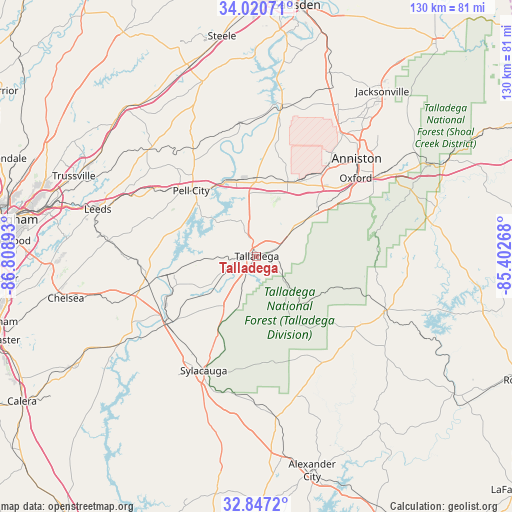
Talladega GPS coordinates[2]
33° 26' 9.384" North, 86° 6' 20.88" West
| Map corner | latitude | longitude |
|---|---|---|
| Upper-left | 34.02071°, | -86.80893° |
| Center: | 33.43594°, | -86.1058° |
| Lower-right: | 32.8472°, | -85.40268° |
| Map W x H: | 130.5×130.5 km | = 81.1×81.1mi |
| max Lat: | 71.29058° ⇑83.4% North |
| Talladega: | 33.43594° |
| min Lat: | ⇓16.6% South 19.06759° |
| min Long | Talladega | max Long |
| -171.73463° | -86.1058° | -66.98998° |
| W 52.6%⇐ | ⇒47.4% E |
Elevation
Elevation of Talladega is 170 m = 558 ft, and this is 124.8 m = 409 ft below average elevation for this country.
| Max E: |
3189 m = 10463 ft | 57.1% |
| Avg. | 294.8 m = 967 ft | |
| Talladega | 170 m = 558 ft | |
Min E: |
-60 m = -197 ft | 42.9% |
See also: United States elevation on elevation.city.
Geographical zone
Talladega is located in North temperate zone (between Tropic of Cancer and the Arctic Circle). Distance of this Northern Tropic circle is 1111.8 km =690.8 mi to South.| Distance of | km | miles | from Talladega |
|---|---|---|---|
| North Pole | 6289.3 | 3908 | to North |
| Arctic Circle | 3683.4 | 2288.8 | to North |
| Tropic Cancer | 1111.8 | 690.8 | to South |
| Equator | 3717.7 | 2310.1 | to South |


Nearby cities:
15 places around Talladega: (largest is in red/bold)
• Ashland
30.9 km =19.2 mi,  125°
125°
• Bynum
23.8 km =14.8 mi,  34°
34°
• Childersburg
29 km =18 mi,  232°
232°
• Harpersville
32.5 km =20.2 mi,  251°
251°
• Hobson City
31.8 km =19.8 mi,  49°
49°
• Lincoln
19.7 km =12.2 mi,  356°
356°
• Mignon
31.6 km =19.6 mi,  207°
207°
• Munford
17.8 km =11.1 mi, 54°
• Oak Grove
32.6 km =20.3 mi, 213°
• Oxford
32 km =19.9 mi, 51°
• Pell City
23.6 km =14.7 mi,  314°
314°
• Riverside
21 km =13 mi,  334°
334°
• Sylacauga
32.2 km =20 mi,  204°
204°
• Vincent
29 km =18 mi,  258°
258°
• West End-Cobb Town
32.3 km =20.1 mi,  41°
41°
Sources, notices
• [Note1] Compared only with cities in United States existing in our database
• [Src1] Map data: © OpenStreetMap contributors (CC-BY-SA)
• [Src2] Other city data from geonames.org with taken over terms of usage.
• [Src3] Geographical zone / Annual Mean Temperature by Robert A. Rohde @ Wikipedia
