Rockford geodata
Rockford (Alabama) is a seat of a second-order administrative division; located in United States in America/Chicago (GMT-5) time zone. With population of 449 people, there are 20923 cities with bigger population in this country. Compared to other cities in United States, 85.6% of cities are located further ↑North; 52.3% of cities are located further ←West and 56.4% of cities have lower elevation than Rockford. Note1


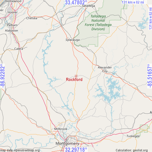
Rockford GPS coordinates[2]
32° 53' 22.452" North, 86° 13' 10.884" West
| Map corner | latitude | longitude |
|---|---|---|
| Upper-left | 33.47802°, | -86.92282° |
| Center: | 32.88957°, | -86.21969° |
| Lower-right: | 32.29718°, | -85.51657° |
| Map W x H: | 131.3×131.3 km | = 81.6×81.6mi |
| max Lat: | 71.29058° ⇑85.6% North |
| Rockford: | 32.88957° |
| min Lat: | ⇓14.4% South 19.06759° |
| min Long | Rockford | max Long |
| -171.73463° | -86.21969° | -66.98998° |
| W 52.3%⇐ | ⇒47.7% E |
Elevation
Elevation of Rockford is 224 m = 735 ft, and this is 70.8 m = 232 ft below average elevation for this country.
| Max E: |
3189 m = 10463 ft | 43.6% |
| Avg. | 294.8 m = 967 ft | |
| Rockford | 224 m = 735 ft | |
Min E: |
-60 m = -197 ft | 56.4% |
See also: United States elevation on elevation.city.
Geographical zone
Rockford is located in North temperate zone (between Tropic of Cancer and the Arctic Circle). Distance of this Northern Tropic circle is 1051.1 km =653.1 mi to South.| Distance of | km | miles | from Rockford |
|---|---|---|---|
| North Pole | 6350.1 | 3945.8 | to North |
| Arctic Circle | 3744.2 | 2326.5 | to North |
| Tropic Cancer | 1051.1 | 653.1 | to South |
| Equator | 3657 | 2272.4 | to South |


Nearby cities:
15 places around Rockford: (largest is in red/bold)
• Alexander City
25.5 km =15.8 mi,  76°
76°
• Deatsville
35.4 km =22 mi,  207°
207°
• Eclectic
33.1 km =20.6 mi,  148°
148°
• Fayetteville
33.3 km =20.7 mi,  328°
328°
• Goodwater
25 km =15.5 mi,  38°
38°
• Hissop
6.2 km =3.9 mi,  87°
87°
• Hollins
26.3 km =16.3 mi,  15°
15°
• Holtville
29.9 km =18.6 mi,  199°
199°
• Jacksons Gap
38.1 km =23.7 mi, 90°
• Marbury
31.5 km =19.6 mi,  228°
228°
• Mignon
32.9 km =20.4 mi,  353°
353°
• Oak Grove
34.4 km =21.4 mi, 347°
• Our Town
25 km =15.5 mi,  105°
105°
• Stewartville
21.2 km =13.2 mi, 353°
• Sylacauga
31.7 km =19.7 mi, 354°
Sources, notices
• [Note1] Compared only with cities in United States existing in our database
• [Src1] Map data: © OpenStreetMap contributors (CC-BY-SA)
• [Src2] Other city data from geonames.org with taken over terms of usage.
• [Src3] Geographical zone / Annual Mean Temperature by Robert A. Rohde @ Wikipedia
