Arkansas City geodata
Arkansas City (Arkansas) is a seat of a second-order administrative division; located in United States in America/Chicago (GMT-5) time zone. With population of 327 people, there are 20966 cities with bigger population in this country. Compared to other cities in United States, 82.6% of cities are located further ↑North; 62.5% of cities are located further →East and 80.6% of cities have higher elevation than Arkansas City. Note1


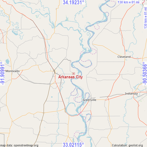
Arkansas City GPS coordinates[2]
33° 36' 31.392" North, 91° 12' 24.408" West
| Map corner | latitude | longitude |
|---|---|---|
| Upper-left | 34.19231°, | -91.90991° |
| Center: | 33.60872°, | -91.20678° |
| Lower-right: | 33.02115°, | -90.50366° |
| Map W x H: | 130.2×130.2 km | = 80.9×80.9mi |
| max Lat: | 71.29058° ⇑82.6% North |
| Arkansas City: | 33.60872° |
| min Lat: | ⇓17.4% South 19.06759° |
| min Long | Arkansas City | max Long |
| -171.73463° | -91.20678° | -66.98998° |
| W 37.5%⇐ | ⇒62.5% E |
Elevation
Elevation of Arkansas City is 44 m = 144 ft, and this is 250.8 m = 823 ft below average elevation for this country.
| Max E: |
3189 m = 10463 ft | 80.6% |
| Avg. | 294.8 m = 967 ft | |
| Arkansas City | 44 m = 144 ft | |
Min E: |
-60 m = -197 ft | 19.4% |
See also: United States elevation on elevation.city.
Geographical zone
Arkansas City is located in North temperate zone (between Tropic of Cancer and the Arctic Circle). Distance of this Northern Tropic circle is 1131 km =702.8 mi to South.| Distance of | km | miles | from Arkansas City |
|---|---|---|---|
| North Pole | 6270.1 | 3896.1 | to North |
| Arctic Circle | 3664.2 | 2276.8 | to North |
| Tropic Cancer | 1131 | 702.8 | to South |
| Equator | 3736.9 | 2322 | to South |


Nearby cities:
15 places around Arkansas City: (largest is in red/bold)
• Boyle
45.7 km =28.4 mi,  76°
76°
• Cleveland
47.1 km =29.3 mi,  71°
71°
• Dermott
23.2 km =14.4 mi,  246°
246°
• Dumas
40.6 km =25.2 mi,  319°
319°
• Gould
53.1 km =33 mi, 321°
• Greenville
26.1 km =16.2 mi,  148°
148°
• Lake Village
31.9 km =19.8 mi,  192°
192°
• Leland
36.5 km =22.7 mi,  128°
128°
• McGehee
18 km =11.2 mi,  277°
277°
• Metcalfe
25.3 km =15.7 mi, 132°
• Mound Bayou
53.5 km =33.2 mi,  55°
55°
• Pea Ridge
36.7 km =22.8 mi,  340°
340°
• Renova
48.7 km =30.3 mi, 67°
• Rosedale
31.8 km =19.8 mi,  31°
31°
• Shaw
40 km =24.9 mi,  91°
91°
Sources, notices
• [Note1] Compared only with cities in United States existing in our database
• [Src1] Map data: © OpenStreetMap contributors (CC-BY-SA)
• [Src2] Other city data from geonames.org with taken over terms of usage.
• [Src3] Geographical zone / Annual Mean Temperature by Robert A. Rohde @ Wikipedia
