Pea Ridge geodata
Pea Ridge (Arkansas) is a populated place; located in United States in America/Chicago (GMT-5) time zone. With population of 2,879 people, there are 9860 cities with bigger population in this country. Compared to other cities in United States, 80.8% of cities are located further ↑North; 62.7% of cities are located further →East and 79.5% of cities have higher elevation than Pea Ridge. Note1


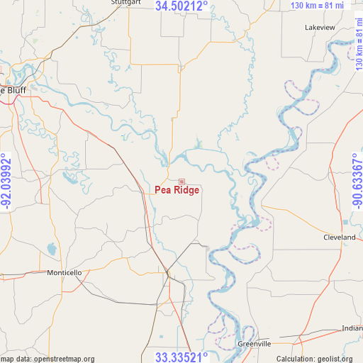
Pea Ridge GPS coordinates[2]
33° 55' 14.376" North, 91° 20' 12.444" West
| Map corner | latitude | longitude |
|---|---|---|
| Upper-left | 34.50212°, | -92.03992° |
| Center: | 33.92066°, | -91.33679° |
| Lower-right: | 33.33521°, | -90.63367° |
| Map W x H: | 129.7×129.7 km | = 80.6×80.6mi |
| max Lat: | 71.29058° ⇑80.8% North |
| Pea Ridge: | 33.92066° |
| min Lat: | ⇓19.2% South 19.06759° |
| min Long | Pea Ridge | max Long |
| -171.73463° | -91.33679° | -66.98998° |
| W 37.3%⇐ | ⇒62.7% E |
Elevation
Elevation of Pea Ridge is 49 m = 161 ft, and this is 245.8 m = 806 ft below average elevation for this country.
| Max E: |
3189 m = 10463 ft | 79.5% |
| Avg. | 294.8 m = 967 ft | |
| Pea Ridge | 49 m = 161 ft | |
Min E: |
-60 m = -197 ft | 20.5% |
See also: United States elevation on elevation.city.
Geographical zone
Pea Ridge is located in North temperate zone (between Tropic of Cancer and the Arctic Circle). Distance of this Northern Tropic circle is 1165.7 km =724.3 mi to South.| Distance of | km | miles | from Pea Ridge |
|---|---|---|---|
| North Pole | 6235.4 | 3874.5 | to North |
| Arctic Circle | 3629.6 | 2255.3 | to North |
| Tropic Cancer | 1165.7 | 724.3 | to South |
| Equator | 3771.6 | 2343.6 | to South |


Nearby cities:
15 places around Pea Ridge: (largest is in red/bold)
• Arkansas City
36.7 km =22.8 mi,  160°
160°
• Cleveland
59.8 km =37.2 mi,  109°
109°
• De Witt
41.4 km =25.7 mi,  359°
359°
• Dermott
44.9 km =27.9 mi,  191°
191°
• Dumas
14.8 km =9.2 mi,  255°
255°
• Gillett
22.2 km =13.8 mi,  350°
350°
• Gould
21.9 km =13.6 mi,  289°
289°
• McGehee
32.9 km =20.4 mi, 190°
• Metcalfe
60.2 km =37.4 mi,  149°
149°
• Monticello
53 km =32.9 mi,  232°
232°
• Mound Bayou
56.4 km =35 mi,  94°
94°
• Renova
59 km =36.7 mi, 105°
• Rosedale
29.5 km =18.3 mi,  104°
104°
• Shelby
52.6 km =32.7 mi, 86°
• Star City
46.8 km =29.1 mi,  273°
273°
Sources, notices
• [Note1] Compared only with cities in United States existing in our database
• [Src1] Map data: © OpenStreetMap contributors (CC-BY-SA)
• [Src2] Other city data from geonames.org with taken over terms of usage.
• [Src3] Geographical zone / Annual Mean Temperature by Robert A. Rohde @ Wikipedia
