Cedarville geodata
Cedarville (Arkansas) is a populated place; located in United States in America/Chicago (GMT-5) time zone. With population of 1,368 people, there are 14272 cities with bigger population in this country. Compared to other cities in United States, 72.3% of cities are located further ↑North; 69.6% of cities are located further →East and 61% of cities have lower elevation than Cedarville. Note1
Administrative division(s):
- Level 1: Arkansas
- Level 2: Crawford County
- Level 3: Township of Cedarville


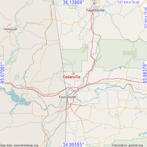
Cedarville GPS coordinates[2]
35° 34' 11.316" North, 94° 22' 0.768" West
| Map corner | latitude | longitude |
|---|---|---|
| Upper-left | 36.13969°, | -95.07001° |
| Center: | 35.56981°, | -94.36688° |
| Lower-right: | 34.99585°, | -93.66376° |
| Map W x H: | 127.2×127.2 km | = 79×79mi |
| max Lat: | 71.29058° ⇑72.3% North |
| Cedarville: | 35.56981° |
| min Lat: | ⇓27.7% South 19.06759° |
| min Long | Cedarville | max Long |
| -171.73463° | -94.36688° | -66.98998° |
| W 30.4%⇐ | ⇒69.6% E |
Elevation
Elevation of Cedarville is 244 m = 801 ft, and this is 50.8 m = 167 ft below average elevation for this country.
| Max E: |
3189 m = 10463 ft | 39% |
| Avg. | 294.8 m = 967 ft | |
| Cedarville | 244 m = 801 ft | |
Min E: |
-60 m = -197 ft | 61% |
See also: United States elevation on elevation.city.
Geographical zone
Cedarville is located in North temperate zone (between Tropic of Cancer and the Arctic Circle). Distance of this Northern Tropic circle is 1349.1 km =838.3 mi to South.| Distance of | km | miles | from Cedarville |
|---|---|---|---|
| North Pole | 6052.1 | 3760.6 | to North |
| Arctic Circle | 3446.2 | 2141.4 | to North |
| Tropic Cancer | 1349.1 | 838.3 | to South |
| Equator | 3955 | 2457.5 | to South |


Nearby cities:
15 places around Cedarville: (largest is in red/bold)
• Alma
16.6 km =10.3 mi,  127°
127°
• Arkoma
24.7 km =15.3 mi,  194°
194°
• Barling
27.8 km =17.3 mi,  167°
167°
• Bell
25.1 km =15.6 mi,  311°
311°
• Cherry Tree
31.4 km =19.5 mi, 307°
• Dyer
22.5 km =14 mi,  112°
112°
• Fort Smith
20.6 km =12.8 mi, 187°
• Kibler
19.8 km =12.3 mi,  141°
141°
• Lavaca
31.3 km =19.4 mi,  145°
145°
• Mountainburg
19.5 km =12.1 mi,  67°
67°
• Mulberry
29.5 km =18.3 mi, 105°
• Muldrow
27.8 km =17.3 mi,  229°
229°
• Remy
19.7 km =12.2 mi, 230°
• Roland
21.3 km =13.2 mi,  218°
218°
• Van Buren
14.9 km =9.3 mi, 173°
Sources, notices
• [Note1] Compared only with cities in United States existing in our database
• [Src1] Map data: © OpenStreetMap contributors (CC-BY-SA)
• [Src2] Other city data from geonames.org with taken over terms of usage.
• [Src3] Geographical zone / Annual Mean Temperature by Robert A. Rohde @ Wikipedia
