Johnson geodata
Johnson (Arkansas) is a populated place; located in United States in America/Chicago (GMT-5) time zone. With population of 3,634 people, there are 8676 cities with bigger population in this country. Compared to other cities in United States, 69.7% of cities are located further ↑North; 69% of cities are located further →East and 81.4% of cities have lower elevation than Johnson. Note1
Administrative division(s):
- Level 1: Arkansas
- Level 2: Washington County
- Level 3: Township of Johnson


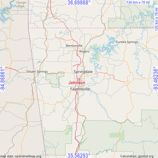
Johnson GPS coordinates[2]
36° 7' 58.296" North, 94° 9' 55.728" West
| Map corner | latitude | longitude |
|---|---|---|
| Upper-left | 36.69868°, | -94.86861° |
| Center: | 36.13286°, | -94.16548° |
| Lower-right: | 35.56293°, | -93.46236° |
| Map W x H: | 126.3×126.3 km | = 78.5×78.5mi |
| max Lat: | 71.29058° ⇑69.7% North |
| Johnson: | 36.13286° |
| min Lat: | ⇓30.3% South 19.06759° |
| min Long | Johnson | max Long |
| -171.73463° | -94.16548° | -66.98998° |
| W 31%⇐ | ⇒69% E |
Elevation
Elevation of Johnson is 369 m = 1211 ft, and this is 74.2 m = 243 ft above average elevation for this country.
| Max E: |
3189 m = 10463 ft | 18.6% |
| Johnson | 369 m 1211 ft | |
| Avg. | 294.8 m = 967 ft | |
Min E: |
-60 m = -197 ft | 81.4% |
See also: United States elevation on elevation.city.
Geographical zone
Johnson is located in North temperate zone (between Tropic of Cancer and the Arctic Circle). Distance of this Northern Tropic circle is 1411.7 km =877.2 mi to South.| Distance of | km | miles | from Johnson |
|---|---|---|---|
| North Pole | 5989.5 | 3721.7 | to North |
| Arctic Circle | 3383.6 | 2102.5 | to North |
| Tropic Cancer | 1411.7 | 877.2 | to South |
| Equator | 4017.6 | 2496.4 | to South |


Nearby cities:
15 places around Johnson: (largest is in red/bold)
• Bethel Heights
9.6 km =6 mi,  19°
19°
• Cave Springs
15.7 km =9.8 mi,  337°
337°
• Elkins
20.3 km =12.6 mi,  135°
135°
• Elm Springs
10.2 km =6.3 mi,  322°
322°
• Farmington
12.5 km =7.8 mi,  215°
215°
• Fayetteville
7.8 km =4.8 mi,  174°
174°
• Goshen
16 km =9.9 mi,  102°
102°
• Greenland
15.4 km =9.6 mi,  183°
183°
• Highfill
22.4 km =13.9 mi,  309°
309°
• Lowell
14 km =8.7 mi,  12°
12°
• Prairie Grove
22.2 km =13.8 mi, 218°
• Rogers
22.5 km =14 mi, 10°
• Springdale
6.8 km =4.2 mi,  28°
28°
• Tontitown
7.9 km =4.9 mi, 309°
• West Fork
23.3 km =14.5 mi,  185°
185°
Sources, notices
• [Note1] Compared only with cities in United States existing in our database
• [Src1] Map data: © OpenStreetMap contributors (CC-BY-SA)
• [Src2] Other city data from geonames.org with taken over terms of usage.
• [Src3] Geographical zone / Annual Mean Temperature by Robert A. Rohde @ Wikipedia
