Springdale geodata
Springdale (Arkansas) is a populated place; located in United States in America/Chicago (GMT-5) time zone. With population of 77,859 people, there are 512 cities with bigger population in this country. Compared to other cities in United States, 69.5% of cities are located further ↑North; 68.9% of cities are located further →East and 84.1% of cities have lower elevation than Springdale. Note1
Administrative division(s):
- Level 1: Arkansas
- Level 2: Washington County
- Level 3: Township of Springdale


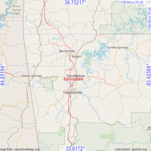
Springdale GPS coordinates[2]
36° 11' 12.264" North, 94° 7' 43.716" West
| Map corner | latitude | longitude |
|---|---|---|
| Upper-left | 36.75217°, | -94.83194° |
| Center: | 36.18674°, | -94.12881° |
| Lower-right: | 35.6172°, | -93.42569° |
| Map W x H: | 126.2×126.2 km | = 78.4×78.4mi |
| max Lat: | 71.29058° ⇑69.5% North |
| Springdale: | 36.18674° |
| min Lat: | ⇓30.5% South 19.06759° |
| min Long | Springdale | max Long |
| -171.73463° | -94.12881° | -66.98998° |
| W 31.1%⇐ | ⇒68.9% E |
Elevation
Elevation of Springdale is 406 m = 1332 ft, and this is 111.2 m = 365 ft above average elevation for this country.
| Max E: |
3189 m = 10463 ft | 15.9% |
| Springdale | 406 m 1332 ft | |
| Avg. | 294.8 m = 967 ft | |
Min E: |
-60 m = -197 ft | 84.1% |
See also: Springdale elevation on elevation.city.
Geographical zone
Springdale is located in North temperate zone (between Tropic of Cancer and the Arctic Circle). Distance of this Northern Tropic circle is 1417.7 km =880.9 mi to South.| Distance of | km | miles | from Springdale |
|---|---|---|---|
| North Pole | 5983.5 | 3718 | to North |
| Arctic Circle | 3377.6 | 2098.7 | to North |
| Tropic Cancer | 1417.7 | 880.9 | to South |
| Equator | 4023.6 | 2500.1 | to South |


Nearby cities:
15 places around Springdale: (largest is in red/bold)
• Bentonville
21.9 km =13.6 mi,  340°
340°
• Bethel Heights
3.1 km =1.9 mi,  359°
359°
• Cave Springs
12.6 km =7.8 mi,  312°
312°
• Elm Springs
9.7 km =6 mi,  282°
282°
• Farmington
19.3 km =12 mi,  213°
213°
• Fayetteville
14 km =8.7 mi,  190°
190°
• Goshen
15.6 km =9.7 mi,  127°
127°
• Greenland
21.8 km =13.5 mi, 191°
• Highfill
22.1 km =13.7 mi,  292°
292°
• Johnson
6.8 km =4.2 mi, 208°
• Little Flock
22.2 km =13.8 mi, 358°
• Lowell
7.6 km =4.7 mi, 358°
• Prairie Creek
18.3 km =11.4 mi,  19°
19°
• Rogers
16.2 km =10.1 mi,  3°
3°
• Tontitown
9.5 km =5.9 mi,  264°
264°
Sources, notices
• [Note1] Compared only with cities in United States existing in our database
• [Src1] Map data: © OpenStreetMap contributors (CC-BY-SA)
• [Src2] Other city data from geonames.org with taken over terms of usage.
• [Src3] Geographical zone / Annual Mean Temperature by Robert A. Rohde @ Wikipedia
