Deenwood geodata
Deenwood (Georgia) is a populated place; located in United States in America/New_York (GMT-4) time zone. With population of 2,146 people, there are 11474 cities with bigger population in this country. Compared to other cities in United States, 90.3% of cities are located further ↑North; 64.3% of cities are located further ←West and 79.3% of cities have higher elevation than Deenwood. Note1


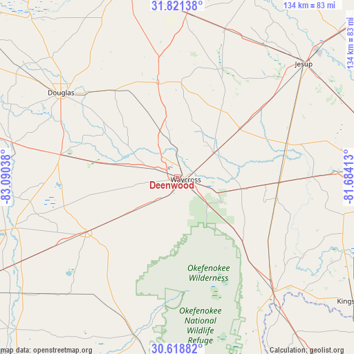
Deenwood GPS coordinates[2]
31° 13' 19.236" North, 82° 23' 14.1" West
| Map corner | latitude | longitude |
|---|---|---|
| Upper-left | 31.82138°, | -83.09038° |
| Center: | 31.22201°, | -82.38725° |
| Lower-right: | 30.61882°, | -81.68413° |
| Map W x H: | 133.7×133.7 km | = 83.1×83.1mi |
| max Lat: | 71.29058° ⇑90.3% North |
| Deenwood: | 31.22201° |
| min Lat: | ⇓9.7% South 19.06759° |
| min Long | Deenwood | max Long |
| -171.73463° | -82.38725° | -66.98998° |
| W 64.3%⇐ | ⇒35.7% E |
Elevation
Elevation of Deenwood is 50 m = 164 ft, and this is 244.8 m = 803 ft below average elevation for this country.
| Max E: |
3189 m = 10463 ft | 79.3% |
| Avg. | 294.8 m = 967 ft | |
| Deenwood | 50 m = 164 ft | |
Min E: |
-60 m = -197 ft | 20.7% |
See also: United States elevation on elevation.city.
Geographical zone
Deenwood is located in North temperate zone (between Tropic of Cancer and the Arctic Circle). Distance of this Northern Tropic circle is 865.6 km =537.9 mi to South.| Distance of | km | miles | from Deenwood |
|---|---|---|---|
| North Pole | 6535.5 | 4061 | to North |
| Arctic Circle | 3929.6 | 2441.7 | to North |
| Tropic Cancer | 865.6 | 537.9 | to South |
| Equator | 3471.6 | 2157.2 | to South |


Nearby cities:
15 places around Deenwood: (largest is in red/bold)
• Alma
36 km =22.4 mi,  348°
348°
• Blackshear
16.7 km =10.4 mi,  55°
55°
• Douglas
54.3 km =33.7 mi,  305°
305°
• Folkston
56.3 km =35 mi,  140°
140°
• Hoboken
24.4 km =15.2 mi,  100°
100°
• Homeland
53.5 km =33.2 mi, 139°
• Homerville
40 km =24.9 mi,  238°
238°
• Nahunta
38.7 km =24 mi,  92°
92°
• Nicholls
40.4 km =25.1 mi,  324°
324°
• Patterson
29.8 km =18.5 mi,  51°
51°
• Pearson
45 km =28 mi,  280°
280°
• Screven
45.8 km =28.5 mi, 50°
• Sunnyside
4.7 km =2.9 mi,  65°
65°
• Talmo
20 km =12.4 mi,  300°
300°
• Waycross
3.1 km =1.9 mi,  107°
107°
Sources, notices
• [Note1] Compared only with cities in United States existing in our database
• [Src1] Map data: © OpenStreetMap contributors (CC-BY-SA)
• [Src2] Other city data from geonames.org with taken over terms of usage.
• [Src3] Geographical zone / Annual Mean Temperature by Robert A. Rohde @ Wikipedia
