Folkston geodata
Folkston (Georgia) is a seat of a second-order administrative division; located in United States in America/New_York (GMT-4) time zone. With population of 5,247 people, there are 6956 cities with bigger population in this country. Compared to other cities in United States, 91% of cities are located further ↑North; 65.5% of cities are located further ←West and 84.8% of cities have higher elevation than Folkston. Note1


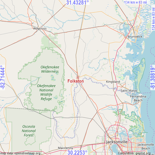
Folkston GPS coordinates[2]
30° 49' 51.42" North, 82° 0' 40.716" West
| Map corner | latitude | longitude |
|---|---|---|
| Upper-left | 31.43281°, | -82.71444° |
| Center: | 30.83095°, | -82.01131° |
| Lower-right: | 30.2253°, | -81.30819° |
| Map W x H: | 134.3×134.3 km | = 83.5×83.5mi |
| max Lat: | 71.29058° ⇑91% North |
| Folkston: | 30.83095° |
| min Lat: | ⇓9% South 19.06759° |
| min Long | Folkston | max Long |
| -171.73463° | -82.01131° | -66.98998° |
| W 65.5%⇐ | ⇒34.5% E |
Elevation
Elevation of Folkston is 29 m = 95 ft, and this is 265.8 m = 872 ft below average elevation for this country.
| Max E: |
3189 m = 10463 ft | 84.8% |
| Avg. | 294.8 m = 967 ft | |
| Folkston | 29 m = 95 ft | |
Min E: |
-60 m = -197 ft | 15.2% |
See also: United States elevation on elevation.city.
Geographical zone
Folkston is located in North temperate zone (between Tropic of Cancer and the Arctic Circle). Distance of this Northern Tropic circle is 822.2 km =510.9 mi to South.| Distance of | km | miles | from Folkston |
|---|---|---|---|
| North Pole | 6579 | 4088 | to North |
| Arctic Circle | 3973.1 | 2468.8 | to North |
| Tropic Cancer | 822.2 | 510.9 | to South |
| Equator | 3428.1 | 2130.1 | to South |


Nearby cities:
15 places around Folkston: (largest is in red/bold)
• Callahan
34.5 km =21.4 mi,  149°
149°
• Fernandina Beach
55.4 km =34.4 mi,  108°
108°
• Hilliard
18 km =11.2 mi, 150°
• Hoboken
40.7 km =25.3 mi,  343°
343°
• Homeland
3 km =1.9 mi, 339°
• Kings Bay Base
42.7 km =26.5 mi,  94°
94°
• Kingsland
30.9 km =19.2 mi,  96°
96°
• Nahunta
41.6 km =25.8 mi,  3°
3°
• Nassau Village-Ratliff
40.5 km =25.2 mi, 151°
• St Marys
42.8 km =26.6 mi, 101°
• St. Marys
45.8 km =28.5 mi, 104°
• Sunnyside
55.3 km =34.4 mi,  325°
325°
• Waycross
53.7 km =33.4 mi,  322°
322°
• Woodbine
31.1 km =19.3 mi,  61°
61°
• Yulee
44.6 km =27.7 mi,  119°
119°
Sources, notices
• [Note1] Compared only with cities in United States existing in our database
• [Src1] Map data: © OpenStreetMap contributors (CC-BY-SA)
• [Src2] Other city data from geonames.org with taken over terms of usage.
• [Src3] Geographical zone / Annual Mean Temperature by Robert A. Rohde @ Wikipedia
