Nicholls geodata
Nicholls (Georgia) is a populated place; located in United States in America/New_York (GMT-4) time zone. With population of 3,331 people, there are 9093 cities with bigger population in this country. Compared to other cities in United States, 89.6% of cities are located further ↑North; 63.2% of cities are located further ←West and 76.5% of cities have higher elevation than Nicholls. Note1


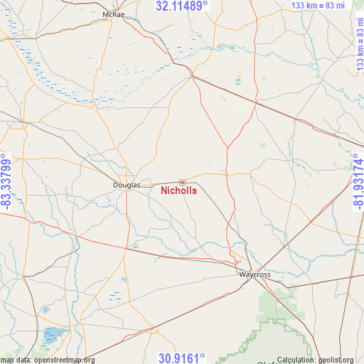
Nicholls GPS coordinates[2]
31° 31' 2.712" North, 82° 38' 5.496" West
| Map corner | latitude | longitude |
|---|---|---|
| Upper-left | 32.11489°, | -83.33799° |
| Center: | 31.51742°, | -82.63486° |
| Lower-right: | 30.9161°, | -81.93174° |
| Map W x H: | 133.3×133.3 km | = 82.8×82.8mi |
| max Lat: | 71.29058° ⇑89.6% North |
| Nicholls: | 31.51742° |
| min Lat: | ⇓10.4% South 19.06759° |
| min Long | Nicholls | max Long |
| -171.73463° | -82.63486° | -66.98998° |
| W 63.2%⇐ | ⇒36.8% E |
Elevation
Elevation of Nicholls is 63 m = 207 ft, and this is 231.8 m = 760 ft below average elevation for this country.
| Max E: |
3189 m = 10463 ft | 76.5% |
| Avg. | 294.8 m = 967 ft | |
| Nicholls | 63 m = 207 ft | |
Min E: |
-60 m = -197 ft | 23.5% |
See also: United States elevation on elevation.city.
Geographical zone
Nicholls is located in North temperate zone (between Tropic of Cancer and the Arctic Circle). Distance of this Northern Tropic circle is 898.5 km =558.3 mi to South.| Distance of | km | miles | from Nicholls |
|---|---|---|---|
| North Pole | 6502.7 | 4040.6 | to North |
| Arctic Circle | 3896.8 | 2421.4 | to North |
| Tropic Cancer | 898.5 | 558.3 | to South |
| Equator | 3504.4 | 2177.5 | to South |


Nearby cities:
15 places around Nicholls: (largest is in red/bold)
• Alma
16.5 km =10.3 mi,  81°
81°
• Baxley
39.7 km =24.7 mi,  43°
43°
• Blackshear
44.1 km =27.4 mi,  122°
122°
• Broxton
26.7 km =16.6 mi,  296°
296°
• Deenwood
40.4 km =25.1 mi,  144°
144°
• Douglas
20.4 km =12.7 mi,  267°
267°
• Hazlehurst
39.3 km =24.4 mi,  5°
5°
• Homerville
54.5 km =33.9 mi,  191°
191°
• Lumber City
46 km =28.6 mi,  354°
354°
• Patterson
49.1 km =30.5 mi,  107°
107°
• Pearson
32 km =19.9 mi,  220°
220°
• Sunnyside
41.6 km =25.8 mi, 138°
• Talmo
23.5 km =14.6 mi,  164°
164°
• Waycross
42.9 km =26.7 mi, 141°
• Willacoochee
43.7 km =27.2 mi,  243°
243°
Sources, notices
• [Note1] Compared only with cities in United States existing in our database
• [Src1] Map data: © OpenStreetMap contributors (CC-BY-SA)
• [Src2] Other city data from geonames.org with taken over terms of usage.
• [Src3] Geographical zone / Annual Mean Temperature by Robert A. Rohde @ Wikipedia
