Elsah geodata
Elsah (Illinois) is a populated place; located in United States in America/Chicago (GMT-5) time zone. With population of 632 people, there are 19334 cities with bigger population in this country. Compared to other cities in United States, 55.3% of cities are located further ↑North; 60.3% of cities are located further →East and 62.6% of cities have higher elevation than Elsah. Note1


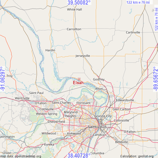
Elsah GPS coordinates[2]
38° 57' 22.176" North, 90° 21' 35.424" West
| Map corner | latitude | longitude |
|---|---|---|
| Upper-left | 39.50082°, | -91.06297° |
| Center: | 38.95616°, | -90.35984° |
| Lower-right: | 38.40728°, | -89.65672° |
| Map W x H: | 121.6×121.6 km | = 75.6×75.6mi |
| max Lat: | 71.29058° ⇑55.3% North |
| Elsah: | 38.95616° |
| min Lat: | ⇓44.7% South 19.06759° |
| min Long | Elsah | max Long |
| -171.73463° | -90.35984° | -66.98998° |
| W 39.7%⇐ | ⇒60.3% E |
Elevation
Elevation of Elsah is 141 m = 463 ft, and this is 153.8 m = 505 ft below average elevation for this country.
| Max E: |
3189 m = 10463 ft | 62.6% |
| Avg. | 294.8 m = 967 ft | |
| Elsah | 141 m = 463 ft | |
Min E: |
-60 m = -197 ft | 37.4% |
See also: United States elevation on elevation.city.
Geographical zone
Elsah is located in North temperate zone (between Tropic of Cancer and the Arctic Circle). Distance of this Northern Tropic circle is 1725.6 km =1072.2 mi to South.| Distance of | km | miles | from Elsah |
|---|---|---|---|
| North Pole | 5675.5 | 3526.6 | to North |
| Arctic Circle | 3069.7 | 1907.4 | to North |
| Tropic Cancer | 1725.6 | 1072.2 | to South |
| Equator | 4331.5 | 2691.5 | to South |


Nearby cities:
15 places around Elsah: (largest is in red/bold)
• Alton
16.8 km =10.4 mi,  115°
115°
• Black Jack
19.8 km =12.3 mi,  156°
156°
• Bridgeton
21.5 km =13.4 mi,  192°
192°
• Brighton
21.1 km =13.1 mi,  63°
63°
• Calverton Park
21.7 km =13.5 mi,  169°
169°
• Florissant
18.8 km =11.7 mi, 170°
• Godfrey
15 km =9.3 mi,  90°
90°
• Grafton
6.4 km =4 mi,  283°
283°
• Hazelwood
20.6 km =12.8 mi,  182°
182°
• Jerseyville
18.4 km =11.4 mi,  8°
8°
• Old Jamestown
14.9 km =9.3 mi,  154°
154°
• Saint Charles
21.8 km =13.5 mi,  208°
208°
• Spanish Lake
22.5 km =14 mi, 146°
• Upper Alton
18.8 km =11.7 mi,  105°
105°
• West Alton
15.6 km =9.7 mi,  130°
130°
Sources, notices
• [Note1] Compared only with cities in United States existing in our database
• [Src1] Map data: © OpenStreetMap contributors (CC-BY-SA)
• [Src2] Other city data from geonames.org with taken over terms of usage.
• [Src3] Geographical zone / Annual Mean Temperature by Robert A. Rohde @ Wikipedia
