Hoyleton geodata
Hoyleton (Illinois) is a populated place; located in United States in America/Chicago (GMT-5) time zone. With population of 510 people, there are 20757 cities with bigger population in this country. Compared to other cities in United States, 59.1% of cities are located further ↑North; 56.9% of cities are located further →East and 59.3% of cities have higher elevation than Hoyleton. Note1
Administrative division(s):
- Level 1: Illinois
- Level 2: Washington County
- Level 3: Township of Hoyleton


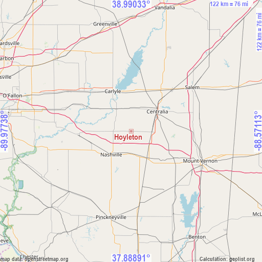
Hoyleton GPS coordinates[2]
38° 26' 30.192" North, 89° 16' 27.3" West
| Map corner | latitude | longitude |
|---|---|---|
| Upper-left | 38.99033°, | -89.97738° |
| Center: | 38.44172°, | -89.27425° |
| Lower-right: | 37.88891°, | -88.57113° |
| Map W x H: | 122.5×122.5 km | = 76.1×76.1mi |
| max Lat: | 71.29058° ⇑59.1% North |
| Hoyleton: | 38.44172° |
| min Lat: | ⇓40.9% South 19.06759° |
| min Long | Hoyleton | max Long |
| -171.73463° | -89.27425° | -66.98998° |
| W 43.1%⇐ | ⇒56.9% E |
Elevation
Elevation of Hoyleton is 158 m = 518 ft, and this is 136.8 m = 449 ft below average elevation for this country.
| Max E: |
3189 m = 10463 ft | 59.3% |
| Avg. | 294.8 m = 967 ft | |
| Hoyleton | 158 m = 518 ft | |
Min E: |
-60 m = -197 ft | 40.7% |
See also: United States elevation on elevation.city.
Geographical zone
Hoyleton is located in North temperate zone (between Tropic of Cancer and the Arctic Circle). Distance of this Northern Tropic circle is 1668.4 km =1036.7 mi to South.| Distance of | km | miles | from Hoyleton |
|---|---|---|---|
| North Pole | 5732.7 | 3562.1 | to North |
| Arctic Circle | 3126.9 | 1943 | to North |
| Tropic Cancer | 1668.4 | 1036.7 | to South |
| Equator | 4274.3 | 2655.9 | to South |


Nearby cities:
15 places around Hoyleton: (largest is in red/bold)
• Ashley
14.4 km =8.9 mi,  149°
149°
• Bartelso
19.8 km =12.3 mi,  302°
302°
• Beckemeyer
23 km =14.3 mi,  322°
322°
• Breese
28.9 km =18 mi,  310°
310°
• Carlyle
20.6 km =12.8 mi,  335°
335°
• Central City
17.5 km =10.9 mi,  47°
47°
• Centralia
15.4 km =9.6 mi, 52°
• Germantown
26.1 km =16.2 mi, 298°
• Irvington
9.7 km =6 mi,  91°
91°
• Nashville
14.3 km =8.9 mi,  220°
220°
• Odin
27.5 km =17.1 mi,  44°
44°
• Okawville
24.1 km =15 mi,  268°
268°
• Sandoval
23.8 km =14.8 mi, 35°
• Wamac
13.8 km =8.6 mi,  57°
57°
• Woodlawn
24.5 km =15.2 mi,  120°
120°
Sources, notices
• [Note1] Compared only with cities in United States existing in our database
• [Src1] Map data: © OpenStreetMap contributors (CC-BY-SA)
• [Src2] Other city data from geonames.org with taken over terms of usage.
• [Src3] Geographical zone / Annual Mean Temperature by Robert A. Rohde @ Wikipedia
