Corydon geodata
Corydon (Indiana) is a seat of a second-order administrative division; located in United States in America/Kentucky/Louisville (GMT-4) time zone. With population of 3,144 people, there are 9394 cities with bigger population in this country. Compared to other cities in United States, 60.6% of cities are located further ↑North; 52.6% of cities are located further ←West and 55.5% of cities have higher elevation than Corydon. Note1


Corydon GPS coordinates[2]
38° 12' 43.236" North, 86° 7' 18.912" West
| Map corner | latitude | longitude |
|---|---|---|
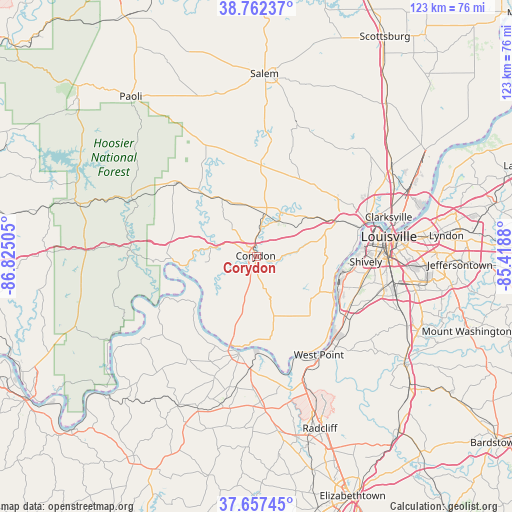
| Upper-left | 38.76237°, | -86.82505° |
| Center: | 38.21201°, | -86.12192° |
| Lower-right: | 37.65745°, | -85.4188° |
| Map W x H: | 122.9×122.9 km | = 76.4×76.4mi |
| max Lat: | 71.29058° ⇑60.6% North |
| Corydon: | 38.21201° |
| min Lat: | ⇓39.4% South 19.06759° |
| min Long | Corydon | max Long |
| -171.73463° | -86.12192° | -66.98998° |
| W 52.6%⇐ | ⇒47.4% E |
Elevation
Elevation of Corydon is 178 m = 584 ft, and this is 116.8 m = 383 ft below average elevation for this country.
| Max E: |
3189 m = 10463 ft | 55.5% |
| Avg. | 294.8 m = 967 ft | |
| Corydon | 178 m = 584 ft | |
Min E: |
-60 m = -197 ft | 44.5% |
See also: United States elevation on elevation.city.
Geographical zone
Corydon is located in North temperate zone (between Tropic of Cancer and the Arctic Circle). Distance of this Northern Tropic circle is 1642.9 km =1020.9 mi to South.| Distance of | km | miles | from Corydon |
|---|---|---|---|
| North Pole | 5758.3 | 3578 | to North |
| Arctic Circle | 3152.4 | 1958.8 | to North |
| Tropic Cancer | 1642.9 | 1020.9 | to South |
| Equator | 4248.8 | 2640.1 | to South |


Nearby cities:
15 places around Corydon: (largest is in red/bold)
• Brandenburg
24.1 km =15 mi,  189°
189°
• Galena
22.1 km =13.7 mi,  45°
45°
• Georgetown
15.7 km =9.8 mi, 54°
• Greenville
21.4 km =13.3 mi,  33°
33°
• Lanesville
12.2 km =7.6 mi,  76°
76°
• Marengo
26.1 km =16.2 mi,  312°
312°
• Milltown
19.8 km =12.3 mi,  317°
317°
• New Albany
27.3 km =17 mi,  72°
72°
• New Salisbury
11.5 km =7.1 mi,  11°
11°
• Palmyra
21.8 km =13.5 mi,  2°
2°
• Pleasure Ridge Park
24.2 km =15 mi,  107°
107°
• Saint Dennis
24.3 km =15.1 mi,  96°
96°
• Shively
26.2 km =16.3 mi,  92°
92°
• Valley Station
24.7 km =15.3 mi,  117°
117°
• West Point
28.3 km =17.6 mi,  146°
146°
Sources, notices
• [Note1] Compared only with cities in United States existing in our database
• [Src1] Map data: © OpenStreetMap contributors (CC-BY-SA)
• [Src2] Other city data from geonames.org with taken over terms of usage.
• [Src3] Geographical zone / Annual Mean Temperature by Robert A. Rohde @ Wikipedia
