Douglass geodata
Douglass (Kansas) is a populated place; located in United States in America/Chicago (GMT-5) time zone. With population of 1,695 people, there are 12930 cities with bigger population in this country. Compared to other cities in United States, 64% of cities are located further ↑North; 75.8% of cities are located further →East and 82% of cities have lower elevation than Douglass. Note1


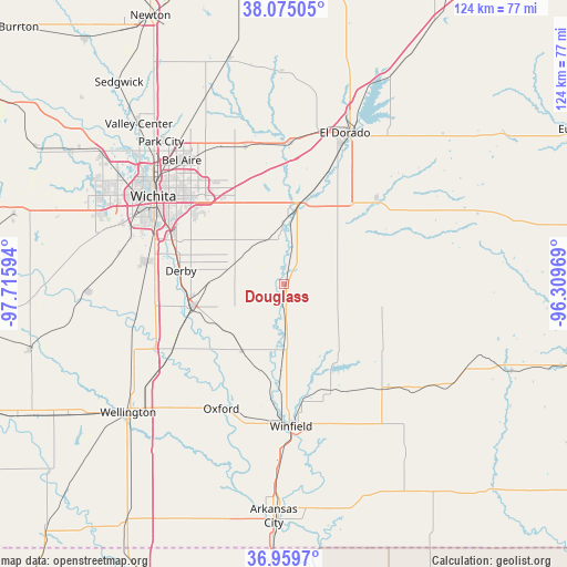
Douglass GPS coordinates[2]
37° 31' 10.056" North, 97° 0' 46.116" West
| Map corner | latitude | longitude |
|---|---|---|
| Upper-left | 38.07505°, | -97.71594° |
| Center: | 37.51946°, | -97.01281° |
| Lower-right: | 36.9597°, | -96.30969° |
| Map W x H: | 124×124 km | = 77.1×77.1mi |
| max Lat: | 71.29058° ⇑64% North |
| Douglass: | 37.51946° |
| min Lat: | ⇓36% South 19.06759° |
| min Long | Douglass | max Long |
| -171.73463° | -97.01281° | -66.98998° |
| W 24.2%⇐ | ⇒75.8% E |
Elevation
Elevation of Douglass is 376 m = 1234 ft, and this is 81.2 m = 266 ft above average elevation for this country.
| Max E: |
3189 m = 10463 ft | 18% |
| Douglass | 376 m 1234 ft | |
| Avg. | 294.8 m = 967 ft | |
Min E: |
-60 m = -197 ft | 82% |
See also: United States elevation on elevation.city.
Geographical zone
Douglass is located in North temperate zone (between Tropic of Cancer and the Arctic Circle). Distance of this Northern Tropic circle is 1565.9 km =973 mi to South.| Distance of | km | miles | from Douglass |
|---|---|---|---|
| North Pole | 5835.3 | 3625.9 | to North |
| Arctic Circle | 3229.4 | 2006.7 | to North |
| Tropic Cancer | 1565.9 | 973 | to South |
| Equator | 4171.8 | 2592.2 | to South |


Nearby cities:
15 places around Douglass: (largest is in red/bold)
• Andover
24.2 km =15 mi,  333°
333°
• Augusta
18.9 km =11.7 mi,  9°
9°
• Belle Plaine
27.5 km =17.1 mi,  239°
239°
• Clay Center
21.3 km =13.2 mi,  90°
90°
• Derby
22.8 km =14.2 mi,  277°
277°
• Eastborough
29 km =18 mi,  310°
310°
• Haysville
30.3 km =18.8 mi, 279°
• Leon
27.8 km =17.3 mi,  46°
46°
• McConnell AFB
24.9 km =15.5 mi,  299°
299°
• Mulvane
21 km =13 mi,  256°
256°
• Oxford
30.6 km =19 mi,  206°
206°
• Rose Hill
11.6 km =7.2 mi,  291°
291°
• Towanda
30.9 km =19.2 mi,  2°
2°
• Udall
17.2 km =10.7 mi, 211°
• Winfield
31.1 km =19.3 mi,  177°
177°
Sources, notices
• [Note1] Compared only with cities in United States existing in our database
• [Src1] Map data: © OpenStreetMap contributors (CC-BY-SA)
• [Src2] Other city data from geonames.org with taken over terms of usage.
• [Src3] Geographical zone / Annual Mean Temperature by Robert A. Rohde @ Wikipedia
