Belle Plaine geodata
Belle Plaine (Kansas) is a populated place; located in United States in America/Chicago (GMT-5) time zone. With population of 1,621 people, there are 13214 cities with bigger population in this country. Compared to other cities in United States, 64.4% of cities are located further ↑North; 76.5% of cities are located further →East and 82.2% of cities have lower elevation than Belle Plaine. Note1
Administrative division(s):
- Level 1: Kansas
- Level 2: Sumner County
- Level 3: Township of Belle Plaine


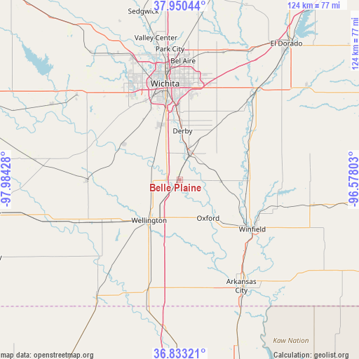
Belle Plaine GPS coordinates[2]
37° 23' 38.076" North, 97° 16' 52.14" West
| Map corner | latitude | longitude |
|---|---|---|
| Upper-left | 37.95044°, | -97.98428° |
| Center: | 37.39391°, | -97.28115° |
| Lower-right: | 36.83321°, | -96.57803° |
| Map W x H: | 124.2×124.2 km | = 77.2×77.2mi |
| max Lat: | 71.29058° ⇑64.4% North |
| Belle Plaine: | 37.39391° |
| min Lat: | ⇓35.6% South 19.06759° |
| min Long | Belle Plaine | max Long |
| -171.73463° | -97.28115° | -66.98998° |
| W 23.5%⇐ | ⇒76.5% E |
Elevation
Elevation of Belle Plaine is 379 m = 1243 ft, and this is 84.2 m = 276 ft above average elevation for this country.
| Max E: |
3189 m = 10463 ft | 17.8% |
| Belle Plaine | 379 m 1243 ft | |
| Avg. | 294.8 m = 967 ft | |
Min E: |
-60 m = -197 ft | 82.2% |
See also: United States elevation on elevation.city.
Geographical zone
Belle Plaine is located in North temperate zone (between Tropic of Cancer and the Arctic Circle). Distance of this Northern Tropic circle is 1551.9 km =964.3 mi to South.| Distance of | km | miles | from Belle Plaine |
|---|---|---|---|
| North Pole | 5849.2 | 3634.5 | to North |
| Arctic Circle | 3243.4 | 2015.4 | to North |
| Tropic Cancer | 1551.9 | 964.3 | to South |
| Equator | 4157.8 | 2583.5 | to South |


Nearby cities:
15 places around Belle Plaine: (largest is in red/bold)
• Andover
37.8 km =23.5 mi,  19°
19°
• Clearwater
23.1 km =14.4 mi,  301°
301°
• Conway Springs
31.9 km =19.8 mi,  269°
269°
• Derby
16.9 km =10.5 mi,  3°
3°
• Douglass
27.5 km =17.1 mi,  59°
59°
• Eastborough
32.7 km =20.3 mi, 2°
• Haysville
20 km =12.4 mi,  341°
341°
• McConnell AFB
26.3 km =16.3 mi, 4°
• Mulvane
9.5 km =5.9 mi, 20°
• Oxford
16.6 km =10.3 mi,  143°
143°
• Rose Hill
22.4 km =13.9 mi,  35°
35°
• Udall
14.8 km =9.2 mi,  92°
92°
• Wellington
16.4 km =10.2 mi,  209°
209°
• Wichita
33.5 km =20.8 mi,  351°
351°
• Winfield
30.5 km =19 mi,  124°
124°
Sources, notices
• [Note1] Compared only with cities in United States existing in our database
• [Src1] Map data: © OpenStreetMap contributors (CC-BY-SA)
• [Src2] Other city data from geonames.org with taken over terms of usage.
• [Src3] Geographical zone / Annual Mean Temperature by Robert A. Rohde @ Wikipedia
