Wellsville geodata
Wellsville (Kansas) is a populated place; located in United States in America/Chicago (GMT-5) time zone. With population of 1,818 people, there are 12478 cities with bigger population in this country. Compared to other cities in United States, 57.2% of cities are located further ↑North; 71.3% of cities are located further →East and 76% of cities have lower elevation than Wellsville. Note1


Wellsville GPS coordinates[2]
38° 43' 6.024" North, 95° 4' 53.904" West
| Map corner | latitude | longitude |
|---|---|---|
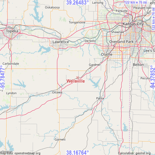
| Upper-left | 39.26483°, | -95.78477° |
| Center: | 38.71834°, | -95.08164° |
| Lower-right: | 38.16764°, | -94.37852° |
| Map W x H: | 122×122 km | = 75.8×75.8mi |
| max Lat: | 71.29058° ⇑57.2% North |
| Wellsville: | 38.71834° |
| min Lat: | ⇓42.8% South 19.06759° |
| min Long | Wellsville | max Long |
| -171.73463° | -95.08164° | -66.98998° |
| W 28.7%⇐ | ⇒71.3% E |
Elevation
Elevation of Wellsville is 320 m = 1050 ft, and this is 25.2 m = 83 ft above average elevation for this country.
| Max E: |
3189 m = 10463 ft | 24% |
| Wellsville | 320 m 1050 ft | |
| Avg. | 294.8 m = 967 ft | |
Min E: |
-60 m = -197 ft | 76% |
See also: United States elevation on elevation.city.
Geographical zone
Wellsville is located in North temperate zone (between Tropic of Cancer and the Arctic Circle). Distance of this Northern Tropic circle is 1699.2 km =1055.8 mi to South.| Distance of | km | miles | from Wellsville |
|---|---|---|---|
| North Pole | 5702 | 3543.1 | to North |
| Arctic Circle | 3096.1 | 1923.8 | to North |
| Tropic Cancer | 1699.2 | 1055.8 | to South |
| Equator | 4305.1 | 2675.1 | to South |


Nearby cities:
15 places around Wellsville: (largest is in red/bold)
• Baldwin City
11.1 km =6.9 mi,  304°
304°
• De Soto
30.6 km =19 mi,  18°
18°
• Edgerton
8.2 km =5.1 mi,  51°
51°
• Eudora
25.1 km =15.6 mi,  356°
356°
• Gardner
16.9 km =10.5 mi, 52°
• Lawrence
31.2 km =19.4 mi,  334°
334°
• Louisburg
36.5 km =22.7 mi,  107°
107°
• New Century, KS
19.6 km =12.2 mi, 53°
• Olathe
29.1 km =18.1 mi, 51°
• Osawatomie
27.1 km =16.8 mi,  155°
155°
• Ottawa
19.8 km =12.3 mi,  234°
234°
• Paola
23.9 km =14.9 mi,  132°
132°
• Pomona
34.4 km =21.4 mi,  249°
249°
• Pomona
35.1 km =21.8 mi, 247°
• Spring Hill
22.4 km =13.9 mi,  82°
82°
Sources, notices
• [Note1] Compared only with cities in United States existing in our database
• [Src1] Map data: © OpenStreetMap contributors (CC-BY-SA)
• [Src2] Other city data from geonames.org with taken over terms of usage.
• [Src3] Geographical zone / Annual Mean Temperature by Robert A. Rohde @ Wikipedia
