Benton geodata
Benton (Louisiana) is a seat of a second-order administrative division; located in United States in America/Chicago (GMT-5) time zone. With population of 2,015 people, there are 11905 cities with bigger population in this country. Compared to other cities in United States, 86.5% of cities are located further ↑North; 68.1% of cities are located further →East and 76% of cities have higher elevation than Benton. Note1


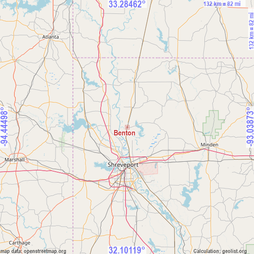
Benton GPS coordinates[2]
32° 41' 41.532" North, 93° 44' 30.66" West
| Map corner | latitude | longitude |
|---|---|---|
| Upper-left | 33.28462°, | -94.44498° |
| Center: | 32.69487°, | -93.74185° |
| Lower-right: | 32.10119°, | -93.03873° |
| Map W x H: | 131.6×131.6 km | = 81.8×81.8mi |
| max Lat: | 71.29058° ⇑86.5% North |
| Benton: | 32.69487° |
| min Lat: | ⇓13.5% South 19.06759° |
| min Long | Benton | max Long |
| -171.73463° | -93.74185° | -66.98998° |
| W 31.9%⇐ | ⇒68.1% E |
Elevation
Elevation of Benton is 66 m = 217 ft, and this is 228.8 m = 751 ft below average elevation for this country.
| Max E: |
3189 m = 10463 ft | 76% |
| Avg. | 294.8 m = 967 ft | |
| Benton | 66 m = 217 ft | |
Min E: |
-60 m = -197 ft | 24% |
See also: United States elevation on elevation.city.
Geographical zone
Benton is located in North temperate zone (between Tropic of Cancer and the Arctic Circle). Distance of this Northern Tropic circle is 1029.4 km =639.6 mi to South.| Distance of | km | miles | from Benton |
|---|---|---|---|
| North Pole | 6371.7 | 3959.2 | to North |
| Arctic Circle | 3765.8 | 2340 | to North |
| Tropic Cancer | 1029.4 | 639.6 | to South |
| Equator | 3635.3 | 2258.9 | to South |


Nearby cities:
15 places around Benton: (largest is in red/bold)
• Blanchard
19 km =11.8 mi,  228°
228°
• Bossier City
19.9 km =12.4 mi,  177°
177°
• Cotton Valley
33.3 km =20.7 mi,  65°
65°
• Doyline
35.7 km =22.2 mi,  119°
119°
• Eastwood
22.5 km =14 mi,  133°
133°
• Greenwood
35.4 km =22 mi,  217°
217°
• Haughton
28.7 km =17.8 mi, 129°
• Lakeview
20.8 km =12.9 mi,  203°
203°
• Mooringsport
20.5 km =12.7 mi,  267°
267°
• Oil City
22.2 km =13.8 mi,  284°
284°
• Plain Dealing
23.8 km =14.8 mi,  10°
10°
• Red Chute
19.6 km =12.2 mi,  142°
142°
• Sarepta
35.2 km =21.9 mi,  51°
51°
• Shreveport
18.9 km =11.7 mi, 182°
• Vivian
30.2 km =18.8 mi,  310°
310°
Sources, notices
• [Note1] Compared only with cities in United States existing in our database
• [Src1] Map data: © OpenStreetMap contributors (CC-BY-SA)
• [Src2] Other city data from geonames.org with taken over terms of usage.
• [Src3] Geographical zone / Annual Mean Temperature by Robert A. Rohde @ Wikipedia
