Potomac geodata
Potomac (Maryland) is a populated place; located in United States in America/New_York (GMT-4) time zone. With population of 44,965 people, there are 1059 cities with bigger population in this country. Compared to other cities in United States, 54.7% of cities are located further ↑North; 79.8% of cities are located further ←West and 68.8% of cities have higher elevation than Potomac. Note1


Potomac GPS coordinates[2]
39° 1' 5.412" North, 77° 12' 30.924" West
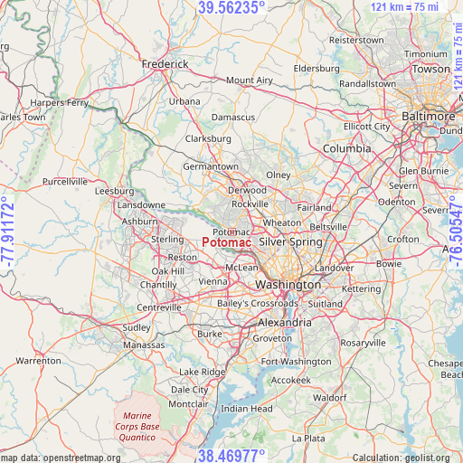
| Map corner | latitude | longitude |
|---|---|---|
| Upper-left | 39.56235°, | -77.91172° |
| Center: | 39.01817°, | -77.20859° |
| Lower-right: | 38.46977°, | -76.50547° |
| Map W x H: | 121.5×121.5 km | = 75.5×75.5mi |
| max Lat: | 71.29058° ⇑54.7% North |
| Potomac: | 39.01817° |
| min Lat: | ⇓45.3% South 19.06759° |
| min Long | Potomac | max Long |
| -171.73463° | -77.20859° | -66.98998° |
| W 79.8%⇐ | ⇒20.2% E |
Elevation
Elevation of Potomac is 108 m = 354 ft, and this is 186.8 m = 613 ft below average elevation for this country.
| Max E: |
3189 m = 10463 ft | 68.8% |
| Avg. | 294.8 m = 967 ft | |
| Potomac | 108 m = 354 ft | |
Min E: |
-60 m = -197 ft | 31.2% |
See also: Potomac elevation on elevation.city.
Geographical zone
Potomac is located in North temperate zone (between Tropic of Cancer and the Arctic Circle). Distance of this Northern Tropic circle is 1732.5 km =1076.5 mi to South.| Distance of | km | miles | from Potomac |
|---|---|---|---|
| North Pole | 5668.6 | 3522.3 | to North |
| Arctic Circle | 3062.8 | 1903.1 | to North |
| Tropic Cancer | 1732.5 | 1076.5 | to South |
| Equator | 4338.4 | 2695.8 | to South |


Nearby cities:
15 places around Potomac: (largest is in red/bold)
• Bethesda
10.2 km =6.3 mi,  114°
114°
• Brookmont
11.4 km =7.1 mi,  137°
137°
• Cabin John
6.5 km =4 mi, 137°
• Chevy Chase View
10.9 km =6.8 mi,  89°
89°
• Garrett Park
10.2 km =6.3 mi,  77°
77°
• Great Falls
7.2 km =4.5 mi,  252°
252°
• McLean
9.7 km =6 mi,  163°
163°
• North Bethesda
8.3 km =5.2 mi,  69°
69°
• North Potomac
8.7 km =5.4 mi,  325°
325°
• Rockville
8.8 km =5.5 mi,  33°
33°
• Somerset
11.3 km =7 mi,  120°
120°
• South Kensington
11.1 km =6.9 mi, 89°
• Travilah
7.4 km =4.6 mi,  320°
320°
• Tysons Corner
11.2 km =7 mi,  189°
189°
• Wolf Trap
11 km =6.8 mi,  217°
217°
Sources, notices
• [Note1] Compared only with cities in United States existing in our database
• [Src1] Map data: © OpenStreetMap contributors (CC-BY-SA)
• [Src2] Other city data from geonames.org with taken over terms of usage.
• [Src3] Geographical zone / Annual Mean Temperature by Robert A. Rohde @ Wikipedia
