Barnhart geodata
Barnhart (Missouri) is a populated place; located in United States in America/Chicago (GMT-5) time zone. With population of 5,682 people, there are 6620 cities with bigger population in this country. Compared to other cities in United States, 59.7% of cities are located further ↑North; 60.5% of cities are located further →East and 63.5% of cities have higher elevation than Barnhart. Note1
Administrative division(s):
- Level 1: Missouri
- Level 2: Jefferson County
- Level 3: Township of Imperial


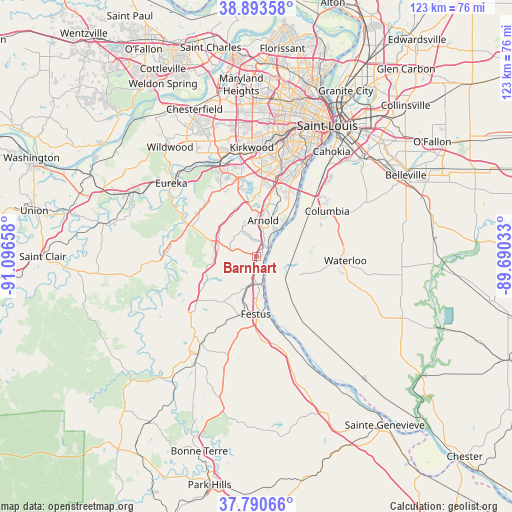
Barnhart GPS coordinates[2]
38° 20' 39.192" North, 90° 23' 36.42" West
| Map corner | latitude | longitude |
|---|---|---|
| Upper-left | 38.89358°, | -91.09658° |
| Center: | 38.34422°, | -90.39345° |
| Lower-right: | 37.79066°, | -89.69033° |
| Map W x H: | 122.6×122.6 km | = 76.2×76.2mi |
| max Lat: | 71.29058° ⇑59.7% North |
| Barnhart: | 38.34422° |
| min Lat: | ⇓40.3% South 19.06759° |
| min Long | Barnhart | max Long |
| -171.73463° | -90.39345° | -66.98998° |
| W 39.5%⇐ | ⇒60.5% E |
Elevation
Elevation of Barnhart is 136 m = 446 ft, and this is 158.8 m = 521 ft below average elevation for this country.
| Max E: |
3189 m = 10463 ft | 63.5% |
| Avg. | 294.8 m = 967 ft | |
| Barnhart | 136 m = 446 ft | |
Min E: |
-60 m = -197 ft | 36.5% |
See also: United States elevation on elevation.city.
Geographical zone
Barnhart is located in North temperate zone (between Tropic of Cancer and the Arctic Circle). Distance of this Northern Tropic circle is 1657.6 km =1030 mi to South.| Distance of | km | miles | from Barnhart |
|---|---|---|---|
| North Pole | 5743.6 | 3568.9 | to North |
| Arctic Circle | 3137.7 | 1949.7 | to North |
| Tropic Cancer | 1657.6 | 1030 | to South |
| Equator | 4263.5 | 2649.2 | to South |


Nearby cities:
15 places around Barnhart: (largest is in red/bold)
• Arnold
9.9 km =6.2 mi,  7°
7°
• Crystal City
13.7 km =8.5 mi,  174°
174°
• Fenton
19.1 km =11.9 mi,  348°
348°
• Festus
13.7 km =8.5 mi,  180°
180°
• Herculaneum
8.5 km =5.3 mi, 172°
• High Ridge
17.8 km =11.1 mi,  315°
315°
• Hillsboro
19.3 km =12 mi,  229°
229°
• Horine
9 km =5.6 mi,  197°
197°
• Imperial
3.1 km =1.9 mi,  24°
24°
• Mehlville
19.3 km =12 mi, 18°
• Murphy
18.2 km =11.3 mi,  333°
333°
• Oakville
16 km =9.9 mi,  28°
28°
• Pevely
6.8 km =4.2 mi, 181°
• Riverside
6.5 km =4 mi, 169°
• Valmeyer
11.1 km =6.9 mi,  112°
112°
Sources, notices
• [Note1] Compared only with cities in United States existing in our database
• [Src1] Map data: © OpenStreetMap contributors (CC-BY-SA)
• [Src2] Other city data from geonames.org with taken over terms of usage.
• [Src3] Geographical zone / Annual Mean Temperature by Robert A. Rohde @ Wikipedia
