Hartville geodata
Hartville (Missouri) is a seat of a second-order administrative division; located in United States in America/Chicago (GMT-5) time zone. With population of 596 people, there are 19749 cities with bigger population in this country. Compared to other cities in United States, 65.1% of cities are located further ↑North; 65.2% of cities are located further →East and 81.3% of cities have lower elevation than Hartville. Note1


Hartville GPS coordinates[2]
37° 15' 3.168" North, 92° 30' 37.584" West
| Map corner | latitude | longitude |
|---|---|---|
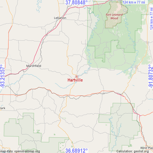
| Upper-left | 37.80848°, | -93.21357° |
| Center: | 37.25088°, | -92.51044° |
| Lower-right: | 36.68912°, | -91.80732° |
| Map W x H: | 124.5×124.5 km | = 77.4×77.4mi |
| max Lat: | 71.29058° ⇑65.1% North |
| Hartville: | 37.25088° |
| min Lat: | ⇓34.9% South 19.06759° |
| min Long | Hartville | max Long |
| -171.73463° | -92.51044° | -66.98998° |
| W 34.8%⇐ | ⇒65.2% E |
Elevation
Elevation of Hartville is 368 m = 1207 ft, and this is 73.2 m = 240 ft above average elevation for this country.
| Max E: |
3189 m = 10463 ft | 18.7% |
| Hartville | 368 m 1207 ft | |
| Avg. | 294.8 m = 967 ft | |
Min E: |
-60 m = -197 ft | 81.3% |
See also: United States elevation on elevation.city.
Geographical zone
Hartville is located in North temperate zone (between Tropic of Cancer and the Arctic Circle). Distance of this Northern Tropic circle is 1536 km =954.4 mi to South.| Distance of | km | miles | from Hartville |
|---|---|---|---|
| North Pole | 5865.2 | 3644.5 | to North |
| Arctic Circle | 3259.3 | 2025.2 | to North |
| Tropic Cancer | 1536 | 954.4 | to South |
| Equator | 4141.9 | 2573.7 | to South |


Nearby cities:
15 places around Hartville: (largest is in red/bold)
• Ava
35.8 km =22.2 mi,  201°
201°
• Cabool
38.9 km =24.2 mi,  111°
111°
• Conway
39.1 km =24.3 mi,  315°
315°
• Fordland
39.5 km =24.5 mi,  254°
254°
• Houston
49.8 km =30.9 mi,  80°
80°
• Lebanon
49.7 km =30.9 mi,  344°
344°
• Mansfield
17.2 km =10.7 mi, 201°
• Marshfield
36.4 km =22.6 mi,  285°
285°
• Mountain Grove
25.6 km =15.9 mi,  121°
121°
• Norwood
18 km =11.2 mi,  151°
151°
• Rogersville
50.5 km =31.4 mi, 252°
• Seymour
25.7 km =16 mi,  243°
243°
• Sparta
57.7 km =35.9 mi, 241°
• Strafford
53.7 km =33.4 mi,  272°
272°
• Willow Springs
55.9 km =34.7 mi, 120°
Sources, notices
• [Note1] Compared only with cities in United States existing in our database
• [Src1] Map data: © OpenStreetMap contributors (CC-BY-SA)
• [Src2] Other city data from geonames.org with taken over terms of usage.
• [Src3] Geographical zone / Annual Mean Temperature by Robert A. Rohde @ Wikipedia
