Fordland geodata
Fordland (Missouri) is a populated place; located in United States in America/Chicago (GMT-5) time zone. With population of 815 people, there are 17673 cities with bigger population in this country. Compared to other cities in United States, 65.4% of cities are located further ↑North; 66.1% of cities are located further →East and 87.6% of cities have lower elevation than Fordland. Note1
Administrative division(s):
- Level 1: Missouri
- Level 2: Webster County
- Level 3: Township of Green Hill


Fordland GPS coordinates[2]
37° 9' 27.18" North, 92° 56' 26.628" West
| Map corner | latitude | longitude |
|---|---|---|
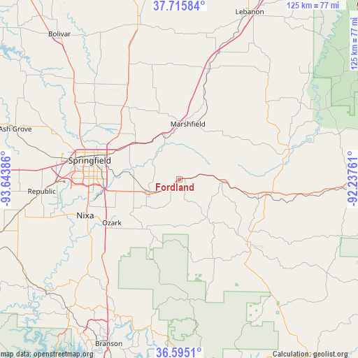
| Upper-left | 37.71584°, | -93.64386° |
| Center: | 37.15755°, | -92.94073° |
| Lower-right: | 36.5951°, | -92.23761° |
| Map W x H: | 124.6×124.6 km | = 77.4×77.4mi |
| max Lat: | 71.29058° ⇑65.4% North |
| Fordland: | 37.15755° |
| min Lat: | ⇓34.6% South 19.06759° |
| min Long | Fordland | max Long |
| -171.73463° | -92.94073° | -66.98998° |
| W 33.9%⇐ | ⇒66.1% E |
Elevation
Elevation of Fordland is 490 m = 1608 ft, and this is 195.2 m = 640 ft above average elevation for this country.
| Max E: |
3189 m = 10463 ft | 12.4% |
| Fordland | 490 m 1608 ft | |
| Avg. | 294.8 m = 967 ft | |
Min E: |
-60 m = -197 ft | 87.6% |
See also: United States elevation on elevation.city.
Geographical zone
Fordland is located in North temperate zone (between Tropic of Cancer and the Arctic Circle). Distance of this Northern Tropic circle is 1525.6 km =948 mi to South.| Distance of | km | miles | from Fordland |
|---|---|---|---|
| North Pole | 5875.5 | 3650.9 | to North |
| Arctic Circle | 3269.6 | 2031.6 | to North |
| Tropic Cancer | 1525.6 | 948 | to South |
| Equator | 4131.5 | 2567.2 | to South |


Nearby cities:
15 places around Fordland: (largest is in red/bold)
• Ava
33.8 km =21 mi,  132°
132°
• Battlefield
38.4 km =23.9 mi,  263°
263°
• Fair Grove
31.3 km =19.4 mi,  323°
323°
• Fremont Hills
29.2 km =18.1 mi,  249°
249°
• Hartville
39.5 km =24.5 mi,  74°
74°
• Highlandville
39.2 km =24.4 mi,  230°
230°
• Mansfield
32.4 km =20.1 mi,  100°
100°
• Marshfield
20.4 km =12.7 mi,  8°
8°
• Nixa
33.8 km =21 mi, 247°
• Ozark
28 km =17.4 mi,  237°
237°
• Rogersville
11.1 km =6.9 mi, 246°
• Seymour
15.3 km =9.5 mi,  94°
94°
• Sparta
21.4 km =13.3 mi,  215°
215°
• Springfield
32.3 km =20.1 mi,  281°
281°
• Strafford
19.9 km =12.4 mi,  308°
308°
Sources, notices
• [Note1] Compared only with cities in United States existing in our database
• [Src1] Map data: © OpenStreetMap contributors (CC-BY-SA)
• [Src2] Other city data from geonames.org with taken over terms of usage.
• [Src3] Geographical zone / Annual Mean Temperature by Robert A. Rohde @ Wikipedia
